Founder and owner of Green Mountain Software, a consulting firm based in the Capital District of New York focusing on SQL Server.
Formerly, a consulting DBA ("and other duties as assigned") by day, and sometimes night, and caver by night (and sometimes day).
Now, a PA student working to add PA-C after my name so I can work as a Physician Assistant.
When I'm not in front of a computer or with my family I'm often out hiking, biking, caving or teaching cave rescue skills.
My original plan after the Grand Canyon was to head to Zion for the day and then over to Bryce where there was available camping, Zion already being full. As my previous post notes, I decided to take an extra night and check out Hoover Dam and stay at a nearby campground. The plan then was the next day to head over to Zion and then Bryce.
Waking up though I had the wisdom to take advantage of the device we call a cell phone but is so much more, to check the weather. Both parks are further north than Grand and also at higher elevations, so I expected them to be cooler. I was right. However, there was also apparently a band of cold weather moving through. Though I had brought lots of warm clothing I wasn’t looking forward to heading into the cold.
I zoomed out on the map on my phone and realized Death Valley was only a couple of hours away. And it’s been on my list of places to visit for much of my life. A quick check of the weather confirmed it would be much warmer. Easy decision. I headed west. The only concern was again camping since all sites were listed “First Come, First Served” but there were quite a few listed and Death Valley is not nearly as popular as the Grand Canyon. So I wasn’t too worried.
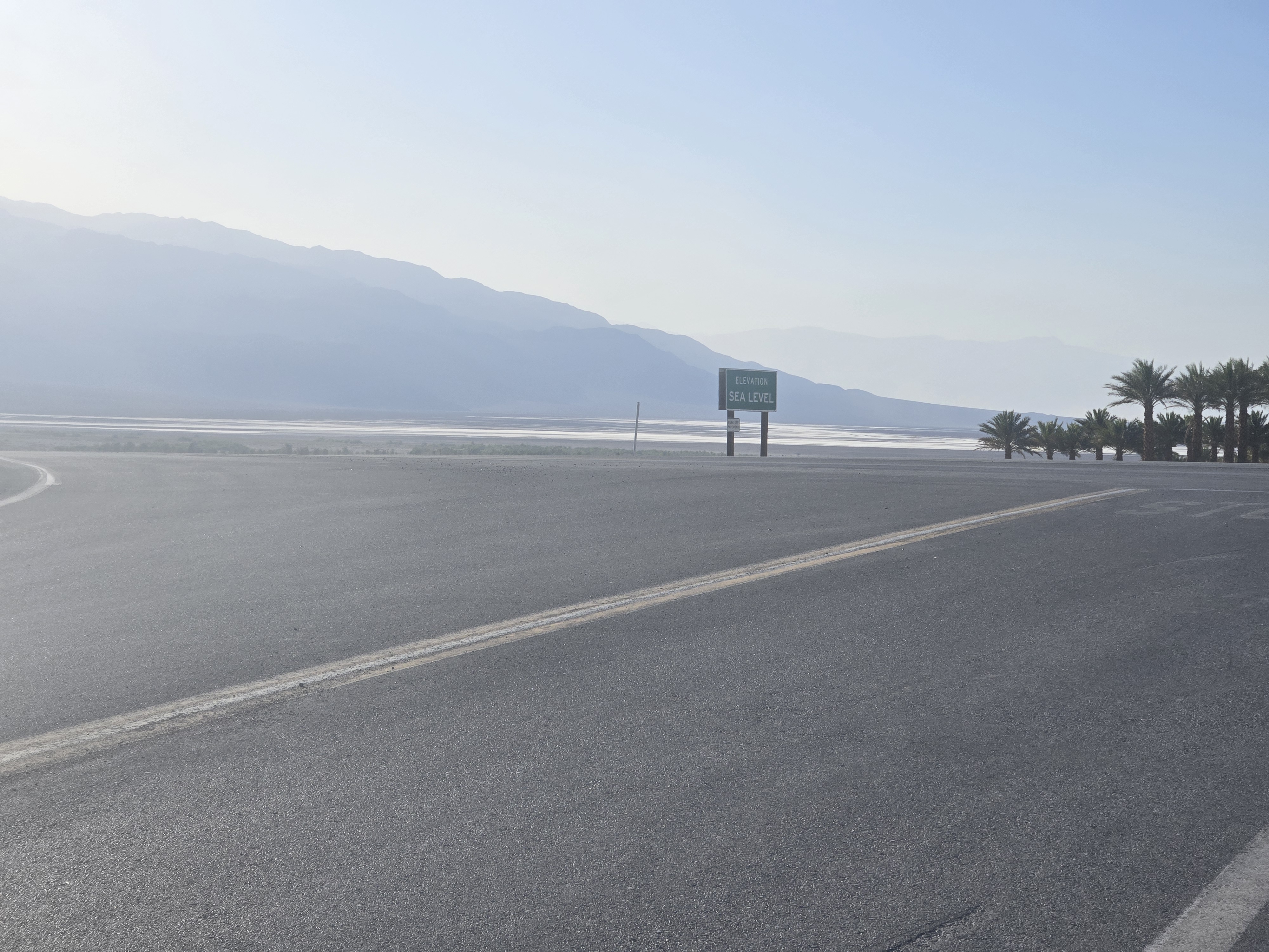
Much of the drive was along desert highways with few facilities along the way. I filled up again outside of Vegas, even though I still had over a ½ tank just out of an abundance of precaution. In Pahrump I stopped by a Walmart and loaded up on some food. More backroads later I saw a sign: Sea Level. By itself this might not be notable, but beyond it was a valley, clearly below sea level. I was there. I had made Death Valley.
I got to the campground and managed to find a beautiful site. At first I thought it was occupied because the receipt on the post was still there, but I confirmed it was an old one. It was this site or one 2 sites over which as basically a bare open sandy spot with no trees. I would have been fine with that, but this one had what I can only describe as a bower of trees bent over a nice pine filled flat circle. Ideal for a tent if I wanted to set mine up, or for simply my pad and sleeping bag.
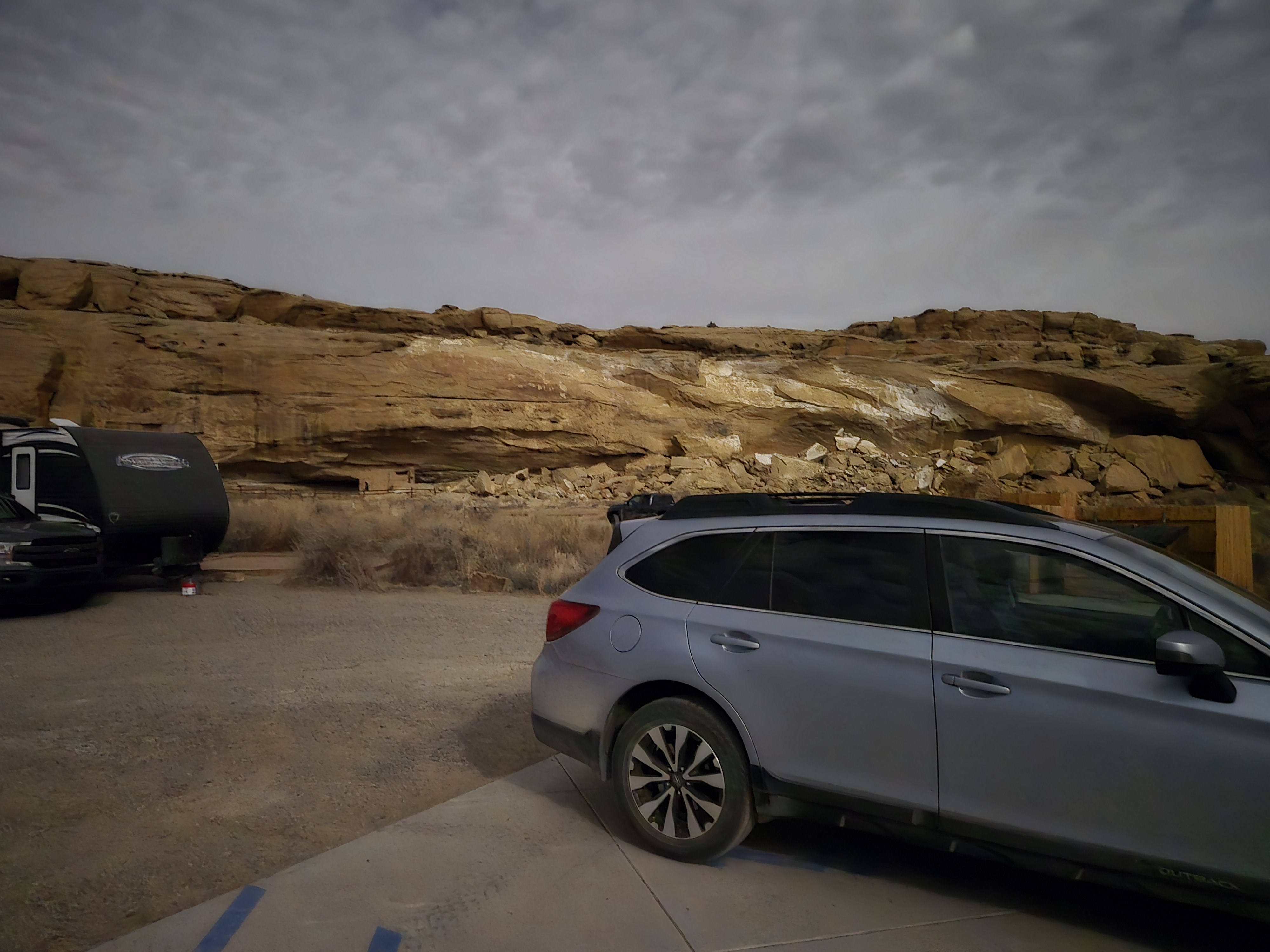
After claiming the site and talking to a ranger I set out. First I checked out an old borax mining camp just a few miles away. Then I headed about 20 miles south to Badwater. This is where I reached a new low in my life. A low of 282 feet below sea level. This is the lower point in North America. And to be honest, I only new a couple of other Americans who have been lower than this and they’ve only done it in steel cans designed to sink (and later rise, a very important design criteria!) I walked out among the salt flats, and yes, I did actually taste some (for science, of course) and even dipped my finger in one of the tiny pools that dotted the flats. Not surprisingly the water was briny, but there is water that seeps up there.
From Badwater I worked my way back a long the road towards the campground. Several different stops and one 2 mile round trip hike and I had seen and walked a lot of Death Valley.
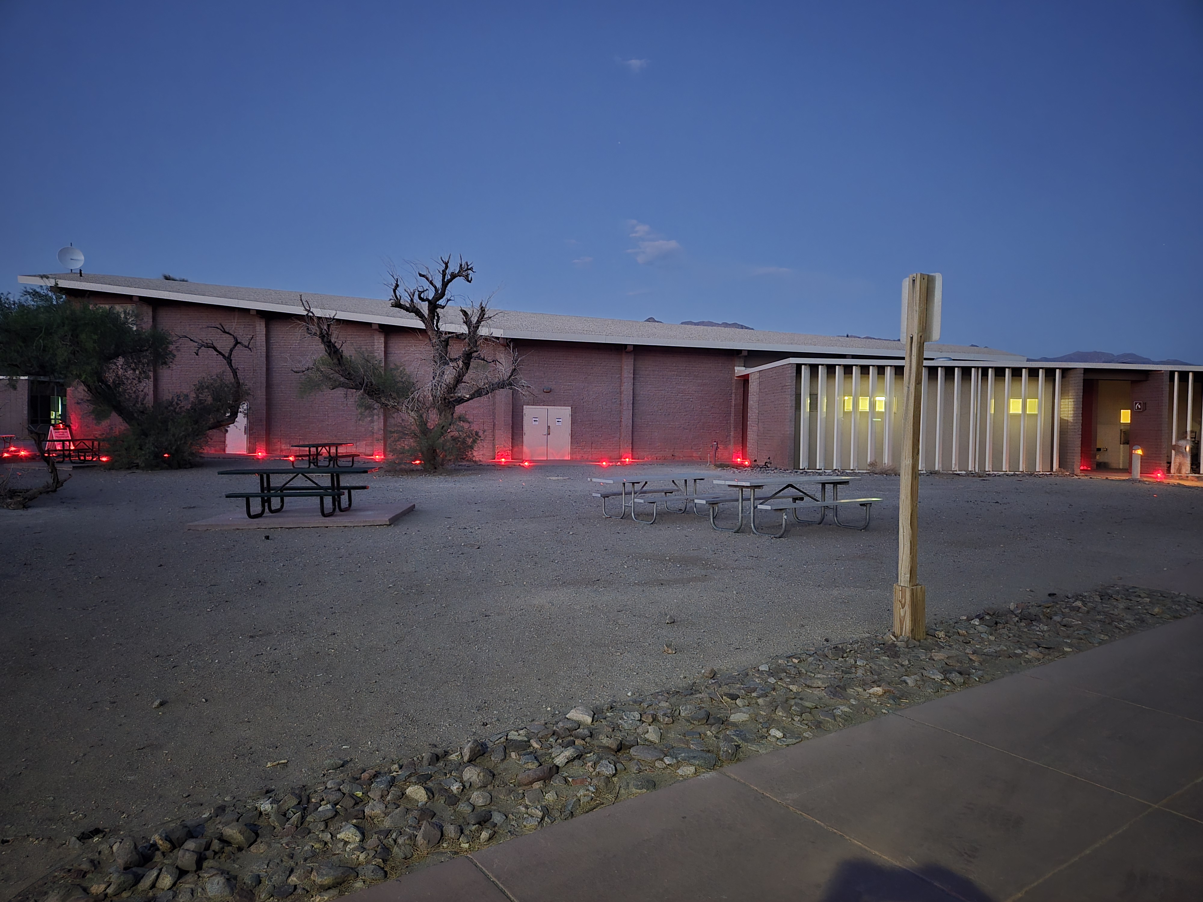
After dinner (and posting my Day 7 post) I walked over to the Visitor Center for a Night Sky presentation put on my Ranger Julianna. It was well attended and I finally learned a few new stars.
After that I made plans for bed. It was VERY windy at this point. It had been most of the day. I honestly saw no point in setting up a tent, even in the nice bower, because I’d have listened to it flap all day. And simply sleeping in my bag on my ground pad, while I’d have been warm enough, again the wind would have annoyed me. So, it turns out as beautiful as my site was, I didn’t take advantage of it. Instead I planned on sleeping in the car like I have been most nights. Though these nights, when my goal isn’t driving, it’s stretched out in back on the ground pad in a nice comfortable position.
Just as I was about to retire, a small camper van rolled up and one of the passengers asked me how they could find a campsite. I explained by now they were probably all full, definitely the ones in this area where. I gave them my copy of the campground map and wished them luck. As they drove off, I realized I could have split my site with them. I didn’t care. It was late, I was going to bed. I could have recouped some of the cost. Oh well.
In the middle of the night I woke up to use the bathroom. The sky was brilliant as ever and the wind had stopped. I decided to compromise a bit and pulled the pad and bag out of the car and put them on the sleeping table. This gave me great view of the sky to fall asleep by. And I did. And I woke up to a beautiful dawn.
So I have reached a new low point and walked the Valley of Death and I’m pretty content.
My original plan after the Grand Canyon was to head to Zion for the day and then over to Bryce where there was available camping, Zion already being full. But I had been wanting to check out Hoover Dam again, since I hadn’t been there since I was a kid and at the time we only drove over it (and perhaps walked around a bit). We had not taken the tour. In my original thinking, there was no way to do this and get to Zion and Bryce in a practical amount of time. Fortunately, with the suggestion of Las Vegas Bay campground as an option, I realized I could make this happen.
So, shortly after dawn I was off to Hoover Dam. My concern though was gas. While driving around the various spots at the Rim of the Canyon, my gas gauge was reading a bit lower than I would have liked. I knew there were a couple of gas stations before Williams Arizona, where I’d hit the Interstate again, but I also knew they were taking advantage of their remoteness and their prices were about 40 cents a gallon more expensive than what Williams had to offer. When I had arrived, this wasn’t an issue. But now, my car was estimating 80 miles left in the tank for about a 60 mile drive. It would be close.
And of course as soon as I turned out of the campground, the computer re-estimated the numbers down to 70 gallons left. If I didn’t stop to get at least one gallon of gas, I’d be cutting it close. I hate to pay more than I have to, especially when they’re obviously taking advantage of their location, but such is life.
But I also knew my car estimates based on most recent usage and other factors. So I figured I’d play it by ear. Sure enough about 20 miles down the road my car now estimated I had about 80 miles left. Yes, it had gone up. By the time I reached a gas station in Williams my car was estimating it had at least 60 miles to go. I was happy. I had “beat the system”. Or something.
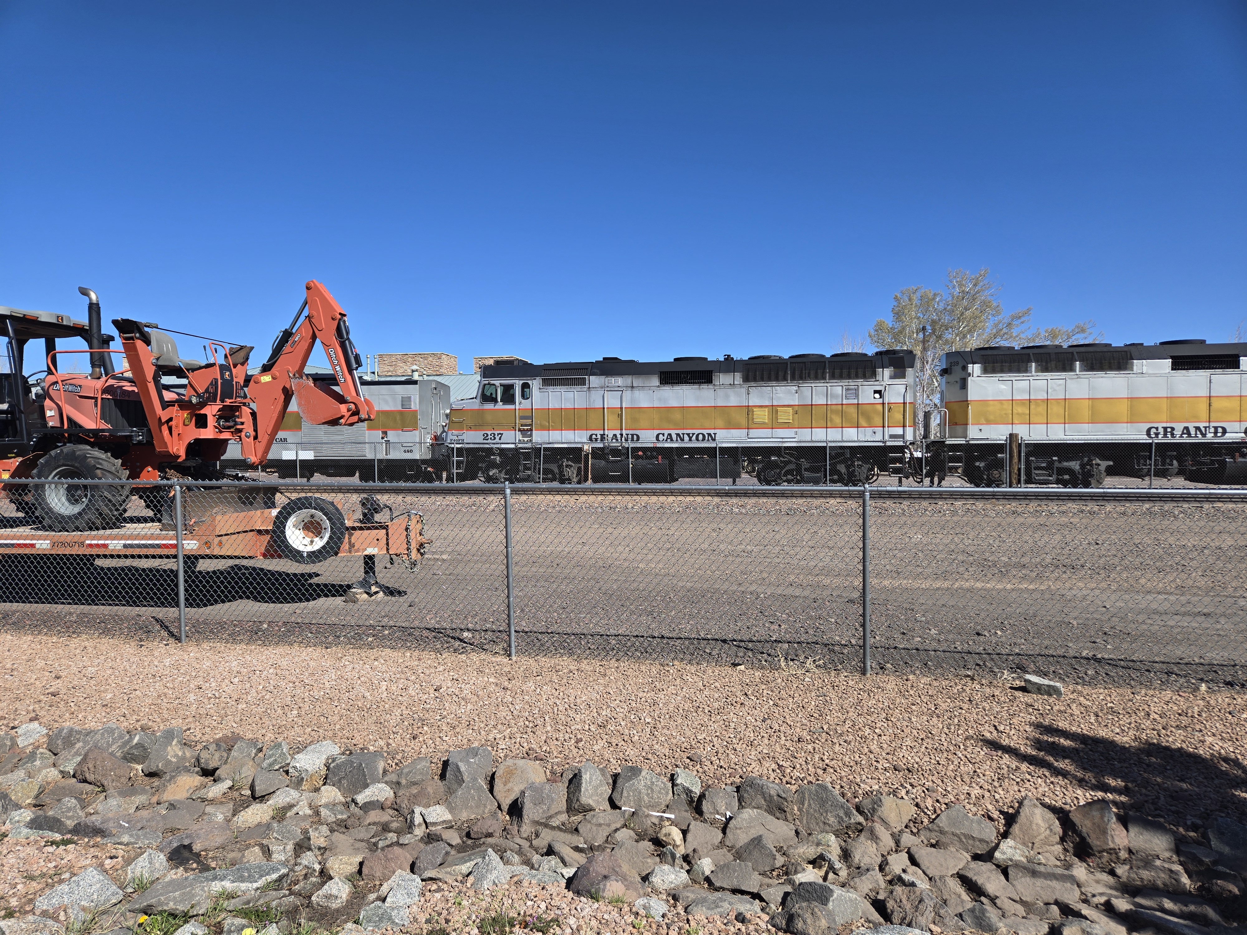
Williams also happens to be the location of the start of the Grand Canyon Railway, so I figured I’d drive over and snap a few pictures. Well my timing was great because I was able to catch the departure of the northbound train. My day was getting even better! With that I then continued to the Hoover Dam.
The last time I had been there, the highway itself still crossed the top of the dam. I knew they had built a new bridge to change this, partly to alleviate the traffic jams, but also because in a post 9/11 world, the idea of a truck bomb being on top of the dam probably made more than a few people nervous. Though, truth to be told, given the mass of the dam, and sadly the lower water levels these days, I don’t think anything short of a nuke would do enough damage to endanger the dam or anything downstream.
While crossing over the new bridge I noticed a walkway along the side of it. I added this to my list of things to check out. I got off at the exit which interestingly enough is about 2-3 miles beyond the dam so you have to double-back.
I had forgotten the dam is a Department of Reclamation site, not a National Park so my new Park Pass wouldn’t help me here. I also didn’t realize if I had bypassed the large, obvious parking garage I could have driven across the dam, driven up the other side a bit and parked for free, saving myself $10. Ironically enough, at the end of the day I decided to do this drive anyway to get some other pictures. So, my advice, if you go, drive all the way across the dam, avoid the one paid parking lot on the other side and continue up. You’ll probably find free parking. Yes, it’s a bit more of a walk, but if you’re like me, you would end up walking over there anyway to check out the views.
Once parked I took the escalator down to the entrance and decided to do the full dam tour (or whatever it’s called). It gets you into a few more places. It’s $30. I’ll admit, I’m still not sure I got my money’s worth. But off I went. First a video of the making and history of the dam and then waiting for my tour time.
Finally I was off for the tour. First we saw one of the bypass tunnels used to divert the Colorado River during the construction. It’s a rough hewn rock tunnel about 50’ in diameter. It’s pretty cool. You stand in a room built inside it atop one of the main penstocks that’s 30’ in diameter. There’s a dull rumble and hum below your feet as thousands of gallons of water per second flow by.
From there you get to see the generator room on the Nevada side. One thing most people don’t realize (and I’ll admit I had forgotten) was that the primary reason for building the dam was flood control and to provide a steady water supply for communities like Las Vegas. The power was secondary and in some ways runs contrary to its primary goal (because the more power they generate, the less water they preserve behind the dam). This is particularly important today with the ongoing climate change because there’s a definite need for the power for communities like Las Vegas, but there’s also been far less snowfall the past winters so there’s far less snowpack, which means less snowmelt, which means the reservoir is far from capacity. In fact as of now, it’s only about 33% full. It’s 165.6’ below what’s considered “full”. Full is considered 1229’ above seal level. It’s at 1063.4’ as I write this. What’s known a deadpool level is 8% capacity and a water level of only 895’ At this level no power can be generated and now water can make it past the dam (since the only outlets for water are through the intake towers and down the penstocks.) I’m sadly betting that some of my readers will see Lake Mead reach deadpool in their lifetimes. (I think there’s a chance I might see it!)
If you only paid for part of the tour, there’s apparently not much more to see. But as I paid the whole dam price, we were taken to see other things, including what’s actually an air vent, but acts like a window on the side of the dam you can look out of. You also get to see an internal staircase that runs from the bottom of the dam all the way to the top. Yes, this is within the dam. The dam itself is not solid but as a number of access tunnels. One purpose of these tunnels is to permit inspection of the large concrete blocks that make up the dam and to monitor any stress cracks forming, other deformation, and more. Also, internal to the dam are seismometers. Originally these were apparently very low tech: literally bowls of mercury on tripods. Being dense, mercury won’t spill out unless something pretty strong shakes the tripod. These have since been replaced by electronic devices, which are in a box on the floor along the path of the tour. So you’re asked VERY firmly to NOT kick the boxes. I think the threat that it stops all the elevators and we’d have to walk that staircase up and out also helps people from doing that.
Another interesting detail about the dam is that it is in fact not attached to the side walls of the canyon in anyway. The mass of water pushes against the arch shape of the dam, holding it in place. This also means that when an earthquake does occur (and it’s near a fault line so they do occur) basically the dam can find its new equilibrium with the canyon walls.
After the tour, I wandered the dam area and took a lot of pictures. On the drive out I pulled over at the parking lot for the pedestrian bridge I mentioned earlier.
This is actually a very well done display and I recommend it. It costs nothing. Well, it might cost you your nerves. Once you’re up on the bridge, there’s a VERY strong wind. I held on to my phone extra hard here because I was truly worried the wind might rip it out of my hands. You’re also 800’ above the Colorado at this point. But the view of the dam is incredible and I recommend it.
After that I headed into Boulder City for dinner and the Las Vegas Bay campground for the night. The campground itself was nothing much. I’m pretty sure when Lake Mead was higher there was an actual by nearby. But tonight, the shore was miles away. You can see on the drive in how much the lake shore has retreated and how some of the boat launch facilities, etc have had to move down the shore more and more to keep up.
I did manage to see a massive thunderstorm far across the lake, but it never bothered me. And with that, I was off to sleep.
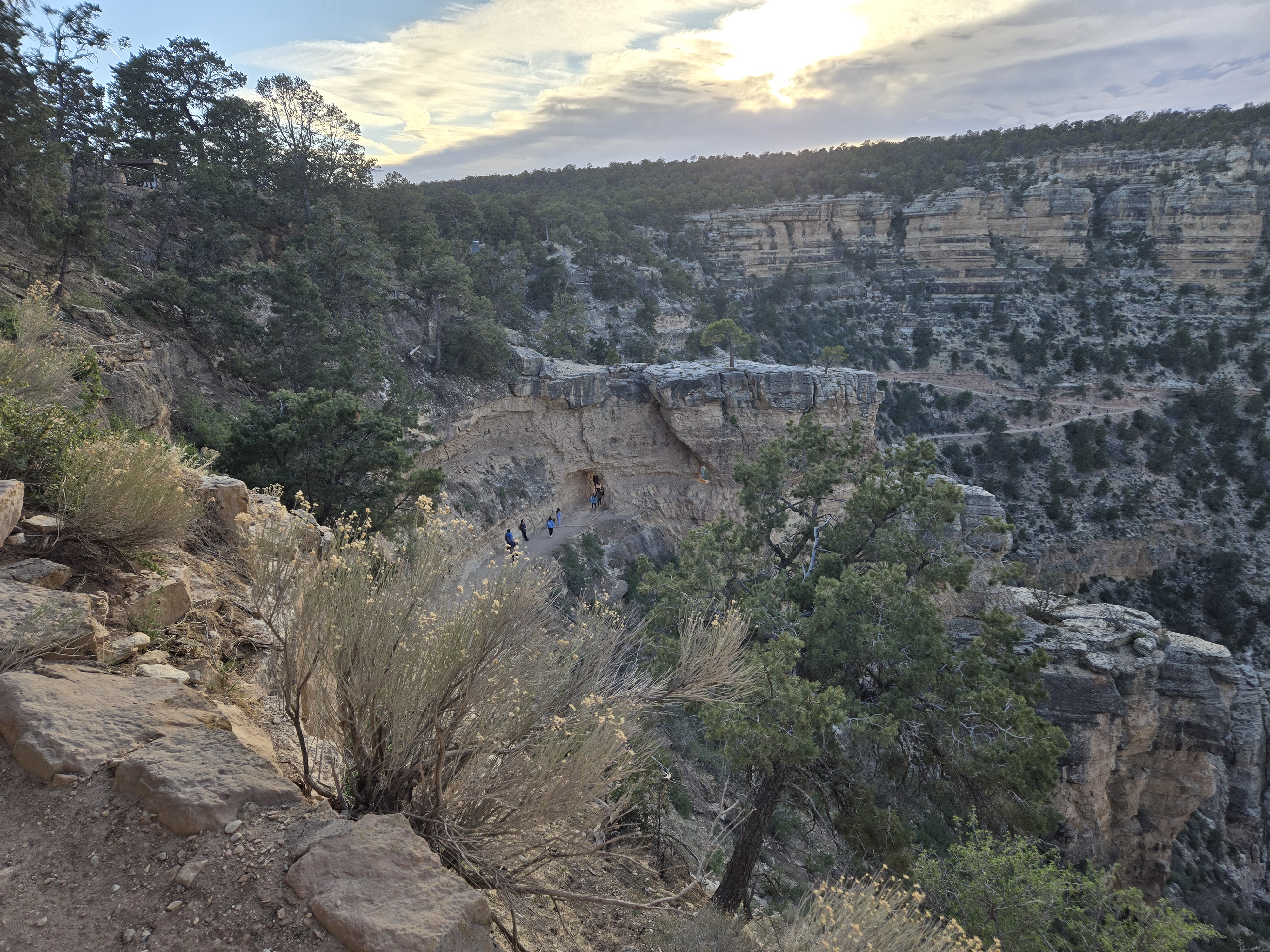
As I had stated earlier, one of my goals was to get an early start from Havasupai Gardens. Ideally I wanted to get to the Rim before there was too much Sun. But also, if possible I wanted to get some moonlight hiking in. I sort of failed at one and barely achieved the other.
I mentioned in the previous post that I had some reading. I had brought a magazine with me (lightweight and I was behind on it). But while wandering the camp I found box marked “Havasupai Gardens Book Return” I later found the “library” for said book. Inside the box there was a copy of Over the Edge: Death in the Canyon. I had seen it at the bookstore on the Rim, but hadn’t bought at the time (since rectified). This provided the basis of my reading material for most of the afternoon and evening. Each chapter breaks down deaths in the Canyon by cause, such as Falls from the Edge, Falls in the Canyon, etc. Of course the last chapter I read focused on hyperthermia and other environmental causes. At the end of each chapter is a table of all known deaths that fit in that chapter’s topic. This was grim reading, especially when one noted the number of middle-aged men suffering from heat exhaustion or exercise induced cardiac arrest. Need I remind the reader that I’m a middle-aged man. As a side note, environmental related deaths is one of the few metrics where middle-aged men approach the numbers of young men (late teens/early twenties) that tend to represent most other deaths.
Let’s just saying falling asleep, my mind was churning a bit. I wasn’t really too worried, given the trail, lots of water, lots of people (more about that in a bit) and I’m not THAT out of shape, and I know what to look for. But still, the irony would have sucked if I didn’t make it.
Generally when I’m camping, even car-camping like much of this trip, I tend to go to bed soon after the Sun goes down. Even with a good headlamp, there seems little point in staying awake to do stuff. As a result, even with the above on my mind, I was probably asleep by 9:00 PM if not earlier.
Between napping in the afternoon, an early bedtime and a full bladder this meant I woke up at just after Midnight. Or so I thought. I saw some moonlight on the Canyon wall to my west. I debated going back to sleep or starting out. Starting out won. I packed my bag and then took out my phone to take a few pictures (that’s a phrase that would confuse folks a generation or two ago!) That’s when I remembered my watch was still on Mountain Daylight Time. Arizona however is on Mountain Standard Time year-round. I had gotten up an hour earlier than I thought. Since I was too lazy to unpack my sleeping bag to go back to bed, I set out for the Rim at 11:45 on the 15th. I was confident I’d avoid the Sun entirely. So did I fail at avoiding it before there was TOO much Sun? I suppose that’s a semantics question between “too much” and “entirely”. In fact, I figured at 4.5 miles, if I got out in four and a half hours, I’d be content. So I set out. With my trusty headlamp. I knew I had plenty of battery, but even if I didn’t worst case, I simply wait for the Moon to come up more, or the Sun to come up more. Either way I was set.
My first goal was the 3-Mile Resthouse. There’s shade here when needed and water. At some future point I’ll relate two incidents that occurred to Randi and I when we where here 29 years ago. This was 1.5 miles away. On the way I did come across a big Cat in the Canyon. But I was safe.
I managed to make the 3-Mile Resthouse by 12:37. I had covered 1.5 miles in under an hour. I was making better time than I had hoped. But the steepest part was yet to come.
And sadly, the Moon had not peeked over the Rim yet. I could see walls of the Canyon bright with moonlight, but no direct moonlight in my path. I had left too early for that it appears. I also had not yet encountered any other hikers. It was really early so I really didn’t expect to, but anyone who has hiked this during the day knows exactly how crowded this section of trail can be. And it normally only gets more crowded the further up you go because so many day hikers (smartly) only hike part way down.
I set out for the 1.5-Mile Resthouse. I was plodding along, a bit out of breath, but feeling I was making decent enough time. I stopped for photos and a few rests. At one point I looked at my watch and said to myself, “Ok, in about 15-20 minutes I should hit the 1.5-Mile Resthouse.”
Not 30 seconds later at a switchback I saw a sign for “Toilet”. I was very confused because I didn’t recall any such facility between the two resthouses. I made my way up the switchback I saw a water faucet and a 911 Emergency Phone. I was really confused now. Then it hit me, I was much further ahead than I expected. I hit the 1.5-Mile Resthouse at 1:50 AM. I was making great time. But knew I was going to face a new problem at the Rim. I’d get up there well before dawn and well before the hiker shuttle from the Backcountry Office would leave at a little after 6:00AM to take me back to my car. I tried to nap a bit here and had almost dozed off when I heard something moving around. At first I thought it was another hiker. But after turning on my headlamp, saw a small canyon mouse interested in my backpack. Fortunately everything was sealed, but still decided I’d best move on. So I set out.
The 1.5 mile rest house sign at night.
I still had not encountered another single hiker. Now I was a bit surprised since I figured at the very least I’d encounter an early-bird overnighter heading out. But I did finally encounter some actual moonlit trail and was able to turn off my headlamp. For about 1 minute. Then I was back into the Rim shadow. I did encounter a few more patches of moonlit path, but that was it. I had left too early to really catch much direct moonlight.
I made the Rim by 3:28. (By the way, I’m not normally so anal about time keeping, but I have tagged photographs that are helping me recall the exact times). I had made the 4.5 mile hike up and out in under 4 hours. That included time for photos and a good 10 minute or so rest at the 1.5-Mile Resthouse.
I also achieved something I suspect very few hikers have done. I did the entire uphill climb from Havasupai Gardens to the Rim without encountering a single other hiker! That alone is a remarkable achievement I think.
But now I had a problem. My car. I looked at some signs and realized I could hike the 4.5 or so miles to my car, or I could wait for the shuttle. I opted to wait. Fortunately I had brought a lot of extra warm gear in my pack in case it was colder overnight than it turned out to be. I put it all on. I then called my mom for her birthday while standing outside the Backcountry Office. Then I waited. And sometimes shivered. And sometimes did some exercise. And shivered. I guess I didn’t need to worry about heat or exercise induced cardiac arrest after all!
Finally a little after 6:00 the shuttle arrived and took me and several other hikers to the South Kaibab trailhead. I then had to double back to my car. My hike was over a little over 24 hours after setting out. It was good.
But it was also 6:45 AM. I had an entire day ahead of me. Going with the “I have nothing really scheduled” I decided I’d stay another night. So I got in line for the “First Come First Served” reservations at around 7:30. It didn’t open until 8:00. So more waiting. But after talking to folks, I came up with a solution on where to spend the next night, a place called Las Vegas Bay Campground. It’s a National Park Service Campground in the Lake Mead Recreational Area. It meant I could see Hoover Dam at my leisure and not worry about finding a spot to camp that night.
After securing a camping spot I set out to do laundry and shower (showers cost $2.50 for 5 minutes, bring quarters!). This was my first chance to do laundry or shower the entire trip. It was well earned.
After being delayed by the panic of a lost wallet, I headed to a talk on the geology of the Canyon given by one of the Rangers. I was late, but it was well worth it and was able to ask her a few questions and gain some knowledge. It was soon after this that I realized that I had DEFINITELY misplaced my ballcap. Now, sentimentally, it really means nothing to me. I have some that do. This one was simply a vendor one given to me by Microsoft. So in that light, no great loss. However, I use it to keep the Sun off my head and out of my eyes. While later shopping for gifts (and the aforementioned book) I picked up a buff to wear. But I still wanted my hat.
After attending another talk my a ranger, this time on wildlife in the Canyon (she loved it when I showed her the picture of the pink rattlesnake) I tried to pin down where I could have lost it. I checked that I had not left it on the Hiker Shuttle (and I know I had it before I boarded since I had taken it and put it into a pack pocket). So I figured I must have lost it after disembarking from the Shuttle and hiking back to my car. So, another ride on a shuttle bus out to South Kaibab. I figured if nothing else, I’d get some more walking in along the rim. I expected to have really no luck finding it. But not 100 yards into the walk back, along the game trail I had taken I spotted it! I had it back.
So I hiked over to the viewpoint (which the name of is escaping me) and took some pictures and then caught the shuttle back to the Visitor Center. By now it was almost 5:00 PM and definitely getting cool again. A wiser man would have simply headed back to his campsite and made dinner. Not me, I swapped to the village shuttle and then got off at the eastern end of Grand Canyon Village and proceeded to check out some of buildings and hike along the Rim. I ended back up at the Bright Angel trailhead. This time it definitely was teeming with hikers!
I finally took the village shuttle back to the Mather Campground stop. I got off, walked back to my campsite and finally made dinner around 7:30 or so. (no photos, so no exact time).
After that, I was off to bed. It was a long day. In addition to my hike out, I estimate I did another 3-4 miles on the Rim. I will say my calves were tight and sore! But so worth it.
I’m already thinking about my next hike in the Canyon.
My goal was to get an early start and beat the heat. After my last hike (29 years ago on my honeymoon with Randi) we failed to do that. In spectacular fashion. But let’s just say if running out of water on the hottest (or nearly so) day of the year in the Canyon can test a marriage and here we are 29 years later, I suppose we did ok.
The Backcountry Office had given me two options. One was to catch a 6:00 AM shuttle to the Kaibab trailhead or to try to snag one of the 12 spots at a small lot just off the road to the trailhead. I figured I’d wake up in the morning and see what my time looked like. Each had its benefits, but waiting for the shuttle meant a possibly later start.
I went to bed soon after dark and so I woke up around 4:00 AM (without an alarm!). I quickly packed and figured I’d risk the parking lot. Sure enough there were plenty of spots available. So after a scramble to grab a last few items from the car (I still forgot some hand sanitizer) I was off. I had to hike to the trailhead (Google says about .7 miles) before I could officially start my hike at 6:15 AM. This gave me about a 20 minute head start over the shuttle bus.
Often when I hike I set two goals: an optimistic one and a pessimistic one. This is even more true when it’s a trail I’m not familiar with or when, like now, I’m not in as good a shape as I’d like to be (and not nearly as young as I used to be!) So, I had an optimistic goal of about 2 miles an hour. That may sound easy, but on a steep trail, much in the Sun, and with a heavy backpack, and given the above age/in-shape factors, I figured I could hope for that. But I’d expect something like 1-1.5mph. My first major goal was the Tonto Trail where it crosses the South Kaibab Trail. There were a few points along the way I’d use to measure my progress.
Well the good news is I did make good time. Based on landmarks, even with stopping to take photos, I was averaging at least 2 mph. I was content. This was my 4th time down the trail, but to be honest, it’s been so long I didn’t remember much, just the general fact that it’s VERY exposed to the Sun and there’s no water. There were some spots that seemed familiar though. Mostly this trail, especially the further you go, is really only recommended for in-shape, experienced hikers who are planning on spending the night. I had two of those three parameters down. So I felt comfortable. And it appears most of the folks I passed on the way down (and I in fact did pass some people who were going down more slowly than me) fit that group. What I didn’t expect to pass was Christopher Robin.
Here is Edward Bear, coming downstairs now, bump, bump, bump, on the back of his head, behind Christopher Robin. It is, as far as he knows, the only way of coming downstairs, but sometimes he feels that there really is another way, if only he could stop bumping for a moment and think of it. And then he feels that perhaps there isn’t. Anyhow, here he is at the bottom, and ready to be introduced to you. Winnie-the-Pooh.
I first spotted this hiker from a switchback perhaps 30′ above him and a few hundred yards away. At first I thought he was standing next to some sort of small structure or something that perhaps the Park Service had put there to monitor the weather or something. It looked flat, smooth, and very obviously man-made.
But as I got closer I was even more confused. It was in fact not something the Park Service had put there. In fact I’m not 100% sure they would have approved of it being there at all.
It was… a kayak. Yes, you read that right a kayak.
I asked him what his plan was and it was in fact to hike to the Colorado and put in and canoe down some number of days (I forgot how many he said). I wished him luck and continued on my way.
It was a few minutes later when I took a water break that I could here the thump thump of the kayak as it bounced down the trail behind him. That’s when I named him Christopher Robin and his kayak Winnie-the-Pooh. Strangely, about 30 minutes later I met 3 folks hiking up from the river (or at least the Tonto Plateau) who asked if I had seen a guy with a kayak. I’m not sure if they were friends or had simply heard about him. In any event, I never saw him again and hope he made it.
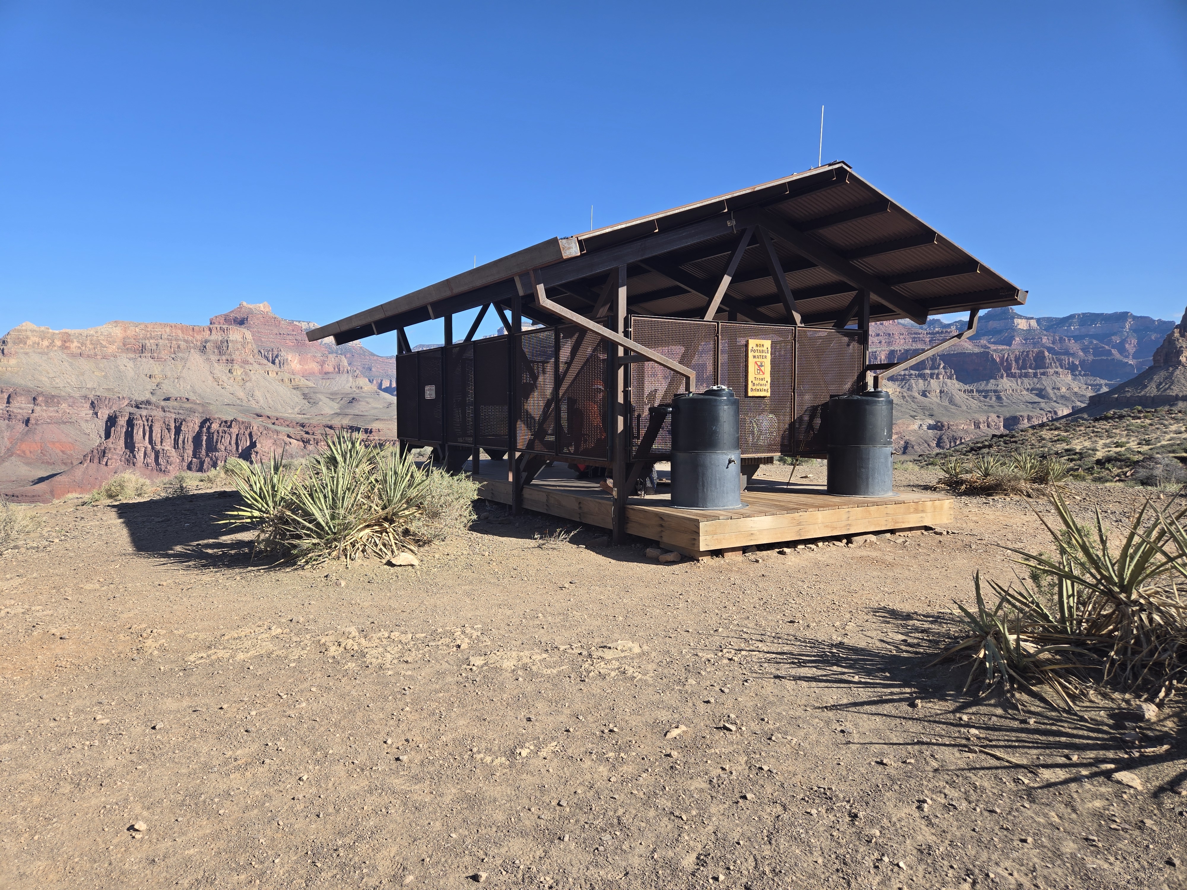
Once at the trail junction I noticed what I’m pretty sure is a new structure since I was there 29 years ago, a Sun shelter. This is in addition to the composting toilets that have been there for as long as I’m aware. Randi and I could have used this last time.
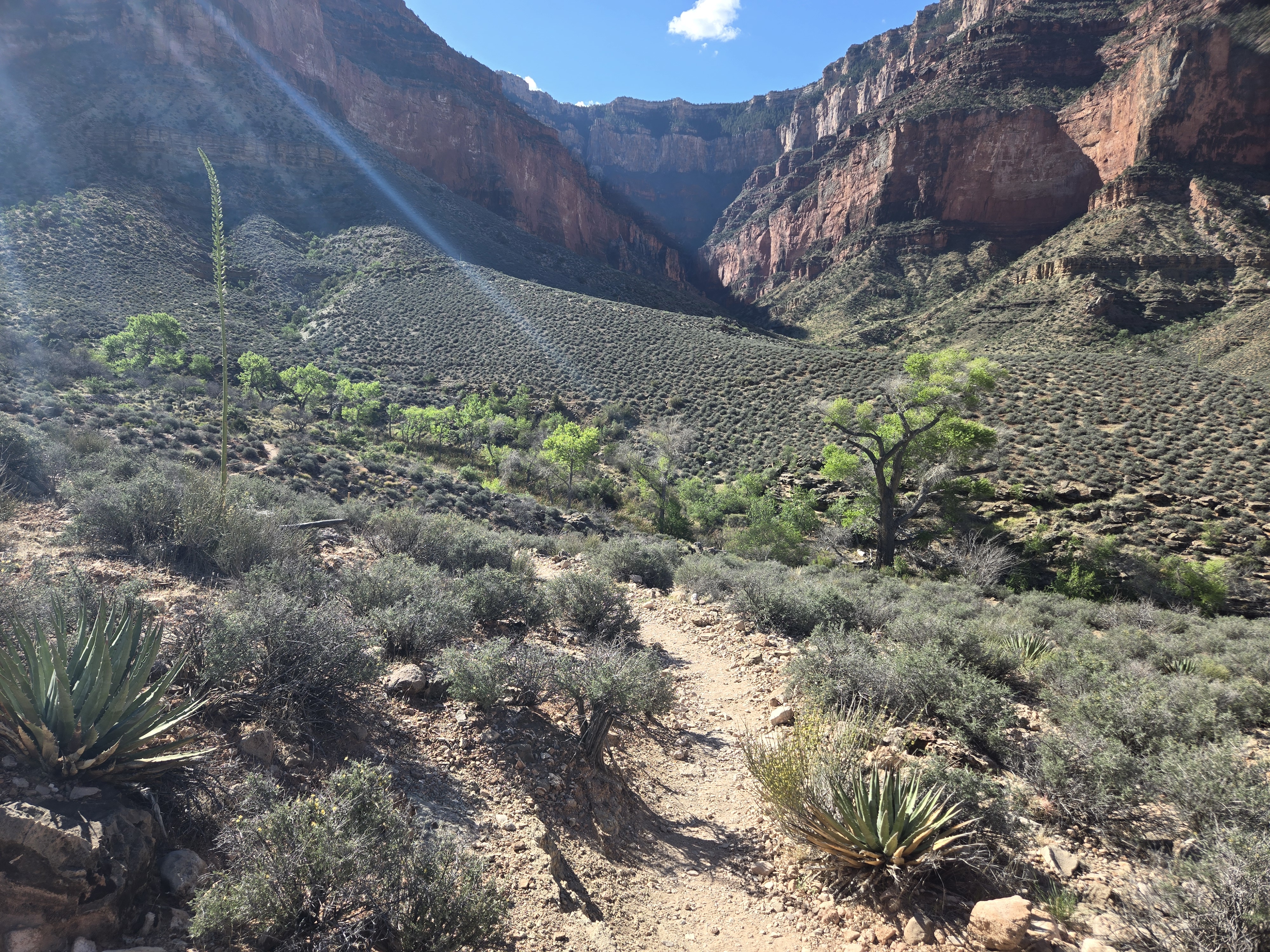
I got here at 8:15, so I was definitely making good time. After a 10 minute potty break and water/food break I was on my way to terra incognita: the Tonto Trail headed west to Havasu Gardens. This was a trail I had never done before. I wasn’t too concerned. It’s fairly flat and there’s non-potable, but treatable, water along the way if I really needed it. The only concern was the Sun. But off I set. I won’t bore you with details. It was uneventful, I saw very few hikers. And I made good time. I will note it’s very obvious in the Canyon where water is. The Cottonwoods grow.
Again, I was making excellent time and was pleased with my progress. I even managed to find a few stretches that still had some shade. My plan of starting very early was paying off.
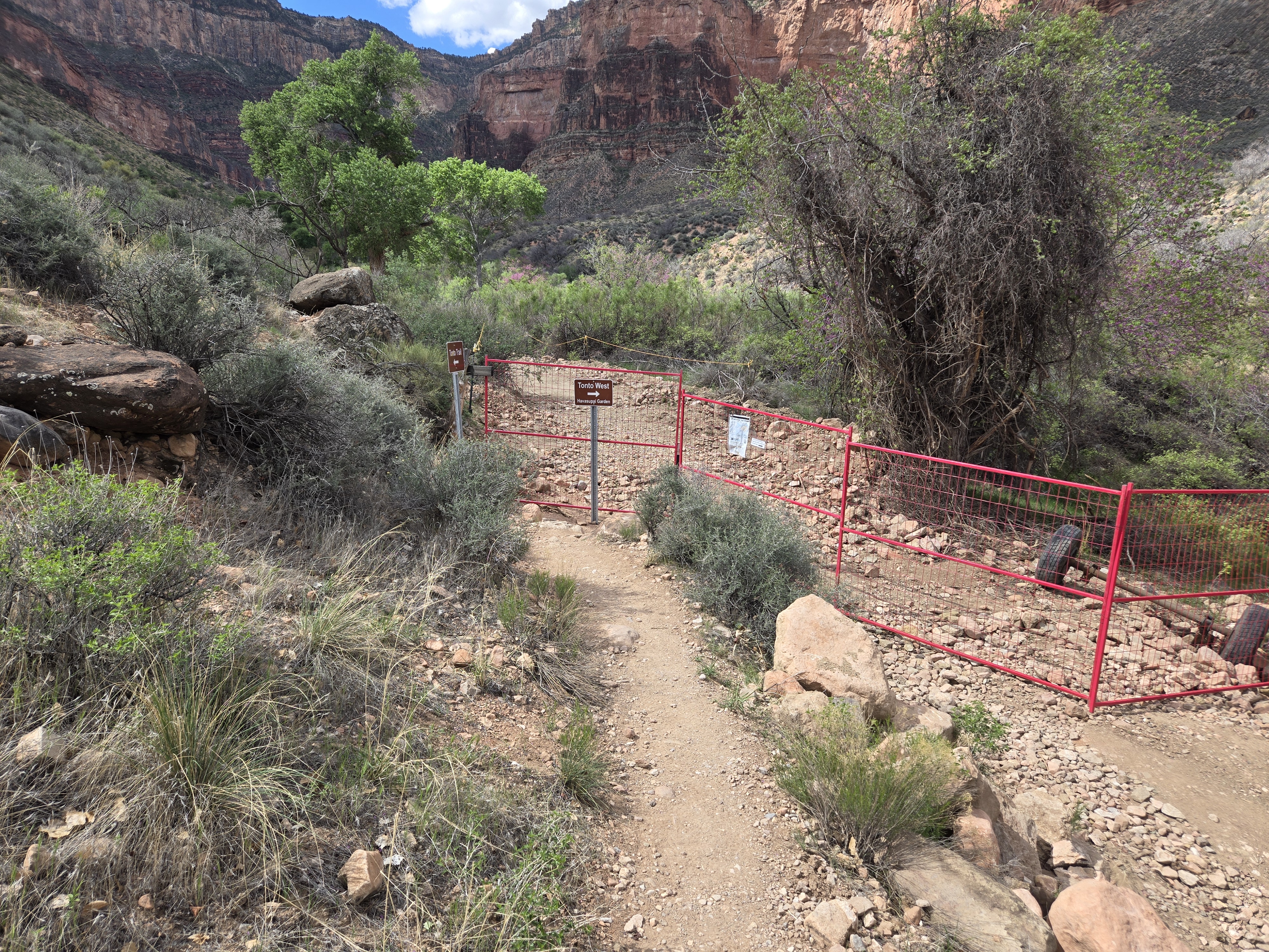
That said as I approached Havasu Gardens I was in for a bit of a surprise and disappointment. Due to the trail construction and pipeline work, rather than hiking into Havasu along the contour I was on, I had to turn away from the Gardens, descend, cross back up a steep section. It was both physiologically and mentally draining. So close and this small hurdle.
But I made it, and well in the time I wanted. I was at Havasu Gardens by 10:53. I was content.
The rest of the day was spent relaxing, reading, and some photo taking. One of the other hikers spied something that caused the Park volunteer to put out a warning sign. I’ll pause to say, if you don’t like snakes, don’t look at the final picture!
Overall, a great day of hiking and I loved being back in the Canyon again and getting the chance to try a new trail! My only concerns… the hike out. Again I wanted an early start. Which I managed to get. More in the next post.
I’ll admit my plans for hiking the Grand Canyon wasn’t too original. It was going to be the same hike I had done before: Down the South Kaibab, stay at Bright Angel Campground, hike ½-way out on the Bright Angel trail to Havasu (formerly Indian) Gardens, spend a night and then the last day out.
And I’ll admit I had some reservations. Well a few. Not reservations for permits to do the hike, which is a good thing with how much my schedule has changed. But reservations about if I COULD do the hike. I’m not as young as I once was and I’m not as in much shape as I’d like to be. And of course, perhaps it was time to do something different. But, sometimes when playing it by ear, it’s easier to fall back on what you know.
Well, turns out it didn’t matter. The segment of the Bright Angel trail from the river up to Havasu Gardens is closed. So, with a change in plans I decided to still hike down the South Kaibab trail, across the Tonto Plateau and then spend just one night in the Canyon. It won’t be quite the same as reaching the Vishnu Schist and seeing the Colorado River up close, but it’ll be good enough to get the experience I want. I always joke about the scene in National Lampoon’s Family Vacation where Chevy Chase’s character stands at the Rim by one of the hotels, looks at it for about 5 minutes and then gets in the car and they leave. Many do close to that. Some are pressed for time. Some have been here before. Some will come back. But I do think if one has the opportunity to get below the Rim, even if it’s just down one of the trails for a mile, I think they should. The experience of being in the Canyon is very different from standing on the Rim. I’m not sure how to describe it, but it’s more visceral, more real. You feel both isolated from the outside world, but also more part of the world itself. There’s far less hustle and bustle. It’s quieter, but full of sound.
Having made my hiking plans I realized I had to make plans for tonight. Fortunately I was able to snag one of the few remaining campsites in Mather Campground. Ironically, it was right next to the one I had last night.
After that I headed out. Since I really had no plans, I decided to heed Horace Greeley’s advice and go West. I had never been west of the Grand Canyon Village so decided to head out to Hermit’s Rest and see how far I got. I walked most of, but did catch the shuttle to cut out two segments and then road the shuttle home. I am so glad I did. I had never seen that part of the Canyon before and there are some magnificent views. I think perhaps next time I’ll try to do a hike down to Hermit’s Rest. Taking the Rim trail west reminded me that no one has truly seen the Grand Canyon. They see slices. Some have seen more slices than others, but ultimately it’s truly impossible to see the entire thing.
Tonight I rest before my hike tomorrow. I know where I’m sleeping tomorrow night. The night after that is still up in the air.
That said, tomorrow’s post will obviously be delayed at least one day.
Note: Pictures will be added later, right now tight on bandwidth.
I’ve mentioned not being on a strict schedule. Which is good. Originally I was going to leave Monday the 7th, after work. But a car repair wasn’t done by then. So then it was going to be Tuesday morning. Of course it ended up being Wednesday around Noon. My original goal had me arriving at the Canyon on Thursday morning. By postponing my departure by 2 days, I figured I could still make it to the Canyon by Saturday morning.
Well here it is, Sunday night and I just arrived after dark (8:37 local time, 11:37 Eastern time). But I’m ok with that. I even managed to score a campsite in the Park itself (which meant not having to find a place along the way). But why the delay?
Well as the previous post notes, I had some car issues that slowed me down. And of course I ended up visiting and staying at Chaco Canyon. But that’s only like a 6 hour drive from the Grand Canyon and I left there around 10:00 AM MDT. So why so late?
Well for one thing I decided to do a bit of food shopping since the next few days stopping by a restaurant was less likely and I was running out and getting sick and tired of what I had packed when I left New York. While paying for the food, I started to panic since I couldn’t find one of my credit cards. I had just used it 8 miles up the road for gas, so I figured I could call to see if they found it and go back. After a frantic search of the car and my pockets multiple times, I did find it in one of my pockets. So I could breath a bit easier after that.
Back on the highway, I still was thinking I’d make the Canyon, specifically Mather Campground, well before dark. I wasn’t scared.
But soon I was petrified. Ok, no, not really. But I saw signs for the Petrified Forest National Park. My paternal grandparents had had a slice of petrified wood that always fascinated me and as such I had always wanted to check it out. A quick check of Google confused me a bit, since it looked like there was a few spots it was calling attention to. But no worry, the entrance was quite literally off the Interstate. I figured I’d pop in, check it out and 20 minutes later be on the road.
Little did I know that actually that’s the North Entrance and the road takes you about 26 miles south to the South Entrance. Along the way there are pull-offs to see the Painted Desert, Blue Mesa and much more. The ranger warned several of us that it could take a couple of hours. He was right. But it was well worth it.
A side note, at Chaco I had decided to pay $80 for an annual pass for the National Parks (in 5 years I can get a lifetime one for the same price, I guess a perk of getting older). Well Chaco is $25, Petrified is $25 and the Grand is $35. So it’s already paid for itself and I have other parks I want to visit on this trip. I also picked up a Park Passport at Petrified so I can collect stamps. Why not.
Anyway, I still had hope to make it to the Grand Canyon before sundown but another sign caught my eye: 65 miles to Winslow. Yes, THAT Winslow Arizona. Since I suppose I’m trying to take it easy on this trip, I just knew I had to stop. And I did. And of course got pictures. And I was far from the only one doing so. At least two other groups were doing the same.
At this point though, any chance of making the campground by sundown was gone. But, it was well worth it.
I’ll add one more note before ending. Several times on this trip, including in Winslow, I’ve managed to be on bits and pieces of the Mother Road, Route 66. And it’s been both cool and sad seeing some of the old hotels (most now dilapidated), restaurants (closed), and gas stations (abandoned).
Written yesterday, but no connection to post, so a day late.
Future posts may also be delayed as I get to more places with limited WiFi.
Today started off fine. I woke up, a bit confused why it was so dark but then remembered my watch is still set to Eastern Time. That was only part of it. Anyone who has spent much time travelling even with a time zone will soon realize that the sun rises earlier on the eastern edge and rises later on the western edge. Conversely sunset is reversed. So not only was I one time zone off, I was rather west in it anyway. I stayed at the Texas Welcome Center along I-40. Most states have their welcome center within a few miles of the border. Not Texas, it’s in Amarillo, about halfway through the state. I suppose that way they only have to build one. That said, it was pretty decent.
I got off an early start and hit the border of New Mexico fairly early. I stopped at their welcome center which is literally right next to the border. However, since I was off to an early start, I decided to get of at Exit 0 in Texas. No, that’s not a typo. It’s right on the border and in fact the merge ramp ends within yards of the New Mexico border. I guess I was going nowhere. (To quote Harry Chapin, “anywhere is a better place to be.”)
Soon after that though the trip hit a snag. My check-engine light came on. Fortunately in my experience with Subarus it’s almost always an O2 sensor so I wasn’t worried. I got off at the next exit with a large enough town and waited for O’Reilly’s Auto Parts to open so I could borrow their OBD2 reader (foolishly I didn’t bring one with me). Sure enough, O2 sensor readings. They claim they can’t clear the codes with theirs so I nursed it until a large town outside of Albuquerque where there was a Walmart. There I picked up a decent reader, reset the sensors and I was off. I also got some Cataclean, I product I’ve had some success with. I used it down the road when my tank was empty enough. So that problem solved.
At this point between my stops and a few “for fun” detours checking out where some frontage roads went (two dead ended, one rejoined the Interstage) I was a bit behind schedule so decided to make for Chaco Canyon National Historical Park. This was probably the first place I visited with my dad years ago. Back then we didn’t have Google. We had AAA Trip-Tiks.
Well, let me go on an aside about Google Maps. One reason I’m not a fan of online maps is because it’s hard to see the big picture, like statewide. This means it’s possible for the online map to take you a way you may want to know and you don’t realize it until too late. This happened to my wife recently in New Jersey (which seems to be particularly bad). Let’s just say in that case there was NO logical reason for Google Maps to suggest anything other than I-95. But it did.
Today, I had a similar problem and it led me to a bit of bad luck. I was following the directions when it suggested I turn off the main road I was on onto a side road. I figured this was a bit strange, but whatever. Well, I should have been thinking more about the speed limit because I got nabbed. Ayup. I suppose I can call it bad luck, but it’s my own damn fault for speeding, regardless of where the map sent me. That said, I’m not even sure if it’ll be a problem (other than the fine) because it was technically on Tribal Land. We’ll see.
But then the fun began. Google Maps continued to take me down slow backroads. I was very careful to follow the speed limit here, despite numerous cars passing me. That said, my general sense of direction was telling me, “this might be the shortest route, but is it the BEST route?” But as they say, in for a penny in for a pound.
So I was thinking right up until Google Maps told me to turn right onto a dirt road. Now, a saner, more cautious person would have continued straight until Google Maps could suggest another route. I am not that person.
Now to be fair, the Subaru of course has all-wheel drive, decent ground clearance, and while I can’t say I have lots of off-road experience, I’m pretty comfortable taking it along roads like this.
Let me just say… it was FUN… bombing along a dirt road in the desert, pausing for the one stray cow. Only a few spots had me worried because they had some rough rocks poking up, but managed those (admittedly I ended up skidding a bit over one rather than steering around.)
I will add too Google Maps said 6.3 miles of unpaved road. Google Maps is a big fat liar. It was about 12 miles.
BUT, at the end was Chaco Canyon. So it worked. And I had fun.
As I drove in, I saw the sign I was dreading. “Campsite Full”. Actually that’s not entirely true. In the spirit of little planning, I hadn’t confirmed if there even was camping. (If there weren’t there were fallback plans). So I went into the Visitors Center to get a pass (got a season pass as I’m pretty sure it’ll be cheaper in the long run) and asked about nearby camping. He asked what I had. “A car, maybe a tent.” “Well if no-one shows up to take the Accessible spot by 4:00 PM, we release that to general camping.” I checked my watch and realized that was only 45 minutes away. So I filled some water bottles (that was the only thing that really had me nervous on the dirt road, if the car had issues I only had soda for hydration) and then went back inside, watched the 25 minute video on Chaco Canyon, wandered around a bit, setup to use their wifi and then, claimed the site. It does feel a bit weird using an Accessible site, but since they run on reservations followed by first-come, first-served, I assume they figure it’s better to rent it out than not.
After parking I did a short hike up to a viewpoint (where I did get some cell access for a bit) and then came back to my campsite, made a cold dinner of PB&J and set up the tent. I’m writing this in Word to later paste into WordPress because I have no service here.
In about 30 minutes I’ll join the Ranger led talk at the campfire and relax.
That’s the journey of today. I have more thoughts, but I think I’ll end up posting those as separate side posts.
One more thing to add, my new phone apparently does do great night shots with a full Moon
Took two sleep breaks last night, the last one at Buc-ees. It’s an interesting place and exactly what I expected. I did splurge and get a breakfast burrito. It started out well, with brisket I think, but by the end, well it wasn’t worth it in my opinion.
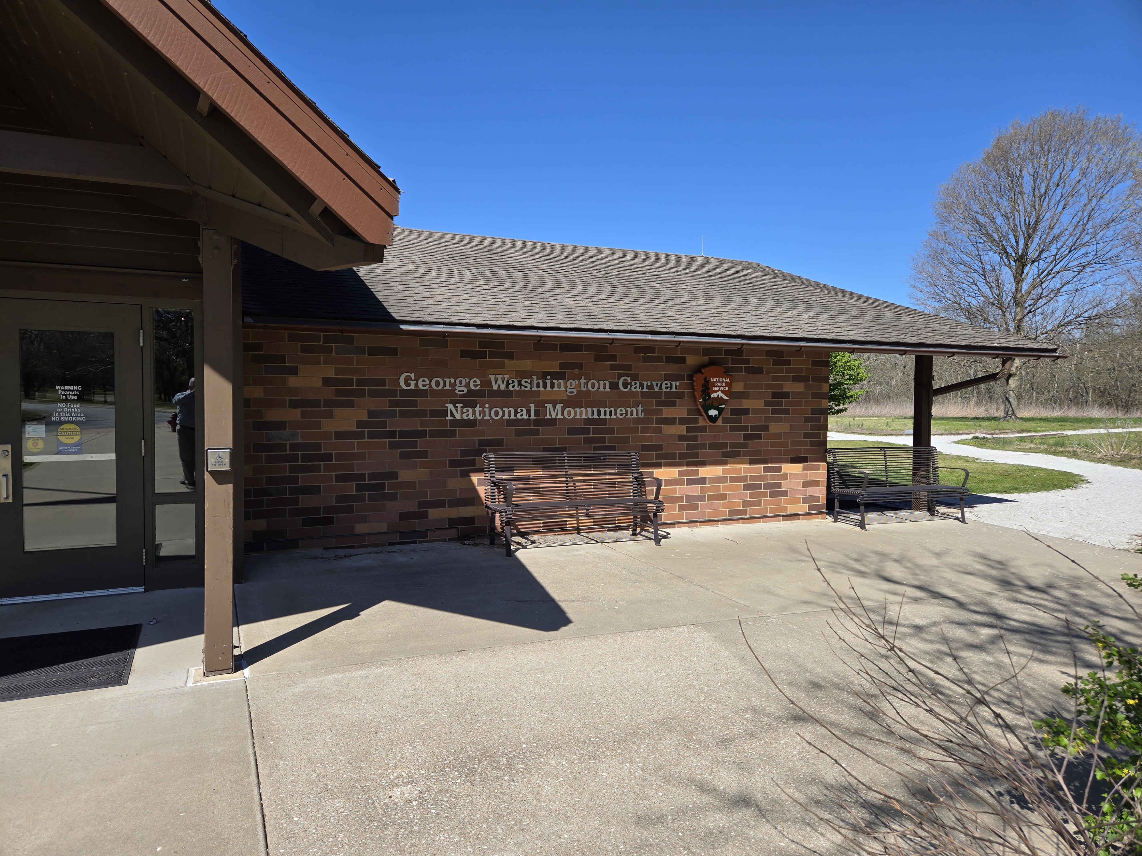
Was making some good time when a sign with the distinctive brown and white of the National Park Service caught my eye (side note, does that brown have a special name? I’ll have to find out!): George Washington Carver National Monument.
I’ve always been interested in him, if only because I love peanuts and a good PB&J (which I did make myself later in the day). So I figured why not.
Sadly, Google Maps was NOT helpful here. It couldn’t give me directions. It simply suggested what I assume came from the website. Normally I wouldn’t care, but on the way I almost missed a turn because I only saw the sign in time.
To say the monument is off the beaten path is an understatement. It’s literally a back road off a back road off a side road from the Interstate. That said, I’d say it’s worth the stop!
So, while not on any of my bucket lists, I’m glad I took the detour.
My next stop led to another unexpected stop. I stopped in Tulsa to take a photo of a place that shares the name of a friend. (sorry, I’d share, but not currently uploaded to my cloud account). While there I decided to put in my contacts. I had been driving all morning with my glasses and figured it was time. Well, my left contact had other ideas and is currently somewhere in my car. Fortunately there was a Lenscrafters not far out of my way so an unplanned stop there got me a replacement for the sinister lens that left me.
From there, a few stops at roadside attractions, but nothing of note.
For the end of the day I decided to make a “run for it” and get to Texas before getting gas. It was close. I wouldn’t say I was on fumes, but my tank was empty and my bladder overfull! But I made Texas.
Next was a few stops trying to find a place to eat and here I am at Backstreet 200 in I believe Panhandle Texas.
I do need to figure out how to get my phone to correctly upload photos over a data connection and not wait for a Wi-Fi one.
That said, I have to say, been thinking a lot about my Dad today. My Mom and Dad probably introduced my wanderlust before I even had memories. This included a trip across country including apparently an unfinished section of I-80 through Colorado where my Mom had to drive while fearing she’d drive over the edge into the Colorado River.
But the first cross-country trip (or nearly we didn’t make the Pacific) that I actually recall was with my Dad, his then girlfriend and her daughter. We took much this same route, especially the last 1000 miles or so. I’ve been this way via car at least twice since then, but that was the first time. I’ll have more thoughts on the matter in the future I’m sure.
Going without a fixed plan or schedule has its advantages and disadvantages. I experienced both today.
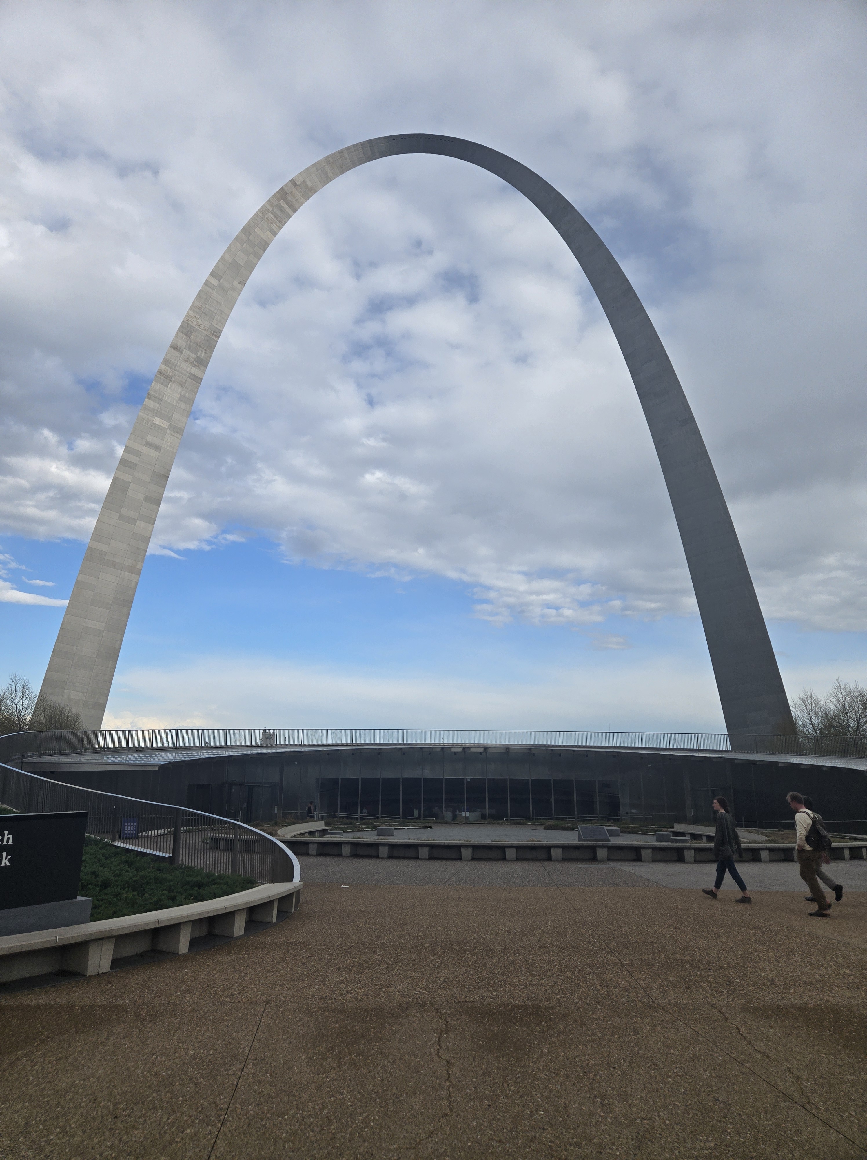
After two overnight stops to sleep, I was well on my way. I had really only one goal today: to make it to the St. Louis Gateway Arch and ride it to the top. The first time I went west, with my dad, his girlfriend and her daughter we arrived after it had closed, so we only saw it from the outside. The past couple of times I was passing through St. Louis, either I again arrived too late or was on too tight of a schedule to stop.
Back to the Arch in a moment.
As I said, there are advantages to no fixed schedule or plan. When I see something that interests me, I can go see it. Today was that day: the Air Force Museum or more accurately: National Museum of the United States Air Force. A quick glance at my phone for the map showed I could give myself about 2 hours there and still make the Gateway Arch. I’ve wanted to visit this museum for years because of my interest in aerospace and because it has a few unique exhibits.
I ended up spending a bit more time here than planned, and far less than I would have liked.
There are three HUGE hangers full of aircraft and some missiles and more. It was well worth the visit. And the cost was in my budget: $0
When I got back to my car I panicked at first thinking I had miscalculated the time and I’d arrive in St. Louis too late. Then I remembered it’s in the Central Time Zone and I in fact had an hour and twenty minutes to spare.
So I set out. I had to make one stop for gas (well two, turns out the first place was actually closed, despite the signs still advertising it being open!, so that set me back 10 minutes.
Finally I arrived close to the Arch, only to discover Google Maps assumed I could simply park in the middle of a street. It took me about another 10 minutes to find legitimate parking.
So between the one gas station and parking, I was down to an hour before closing, which was 6:00 PM.
As I walked down the ramp to the entrance I saw a sign: Last tram runs one hour before closing. It was 5:00 PM. I rushed to the desk hoping against hope I’d sneak in under the window.
Well dear reader, I am sorry to say I was foiled again. The last tram of the day had left. I actually was nearly in tears.
That said, I was able so console myself with the fact that apparently tickets had sold out hours previously. So arriving 10 or 20 minutes earlier would have made no difference, and in fact arriving 3 hours earlier wouldn’t have made a difference.
I did spend some time in the museum itself and took some photos, so it wasn’t a complete waste.
And then headed west.
I’m typing this from a Mexican restaurant somewhere on I-44. I’ll remember the name later.
All in all, a day with some plusses and minuses. Next, find a place to sleep for the night and then figure out my plans for tomorrow and how many miles I want to put in.
Well, things didn’t “go as planned“. Turns out the car wasn’t ready until after 7:00 PM and at that point I figured I’d do another night and dinner with the family and get a start the next day. But, paradoxically, I decided to NOT try to get an early start. Or rather I told myself, if I wake up at like 4:00 AM, I’ll leave then, otherwise, I’ll take my time. So, sometime around 12:30 PM I was finally off.
This was of course after stepping in some cat vomit I had to clean up. Then nearly falling down the last steps into the garage. And then, I must have left a door ajar for too long, but a weak battery I had to jump. Was the Universe trying to tell me something? If so, I wasn’t listening.
I decided for a few reasons to take a trip through the Southern Tier of New York with a stop or two along the way. Well it was more of a “roll-by” of SUNY Cortland, my wife’s alma mater. I had only been there once so I sort of wanted to see it again and take a photo or two. But given I know nothing about the campus and it was cold out, simply took photos from the phone mounted in the car.
From there it was backroads to I-86. Which is where I am now, at a Burger King in Seneca nation. I’m real close to a casino and tempted, but I think I’ll get more miles under my belt tonight.
I’d post some photos, but so far they haven’t synched to my cloud account. I’ll work on that.
So, 8+ hours into my journey I still haven’t left New York yet, but… I’m ok with that. I’m really trying to relax and so far it’s mostly working.