You simply point yourself downhill and put one foot in front of another.
It’s hiking out that’s hard.
Except, that’s not really true. Believe it or not, I often prefer hiking uphill over downhill, especially if the trail is a bit sandy or muddy.
When you hike downhill, you’re actually putting more force on your landing foot than when you’re walking on flat ground or walking uphill. This can be tiring and sore. And if the trail is sandy or muddy, you have to take extra care not to slide and lose your footing. The only real advantage of hiking downhill is aerobically it tends to be easier and you burn fewer calories per mile.
Hiking uphill is often more tiring, but I find it easier on the body. Especially if you’re carrying enough snacks and water and can avoid the hottest part of the day.
In the Grand Canyon, a mistake many novice hikers make is forgetting that hiking in is optional, hiking out is mandatory. So they set off on what they think is a good day hike. “Oh look, Tipoff is only 4.5 miles away. If we get an early start we can finish by mid-afternoon and have time for dinner.”
So they start, perhaps close to sunrise or soon after. Given the path of the trail, they’re not in the bright sunlight for the first mile or so. The hiking is easy going. Things are feeling good. Then they come around the corner and are now on the eastern, more open side of the O’Neill Butte. Now it’s starting to get to be closer to say 10:00 AM. The Canyon is heating up. But they’re feeling good. They continue hiking. Now they’re starting to sweat, but that’s ok, they’ve got plenty of water that they’ve barely touched. And finally they can see the shelter at Tipoff. So they proceed. They get there around 11:00 AM. They’re feeling good. They’re sitting in the only shady spot for miles.
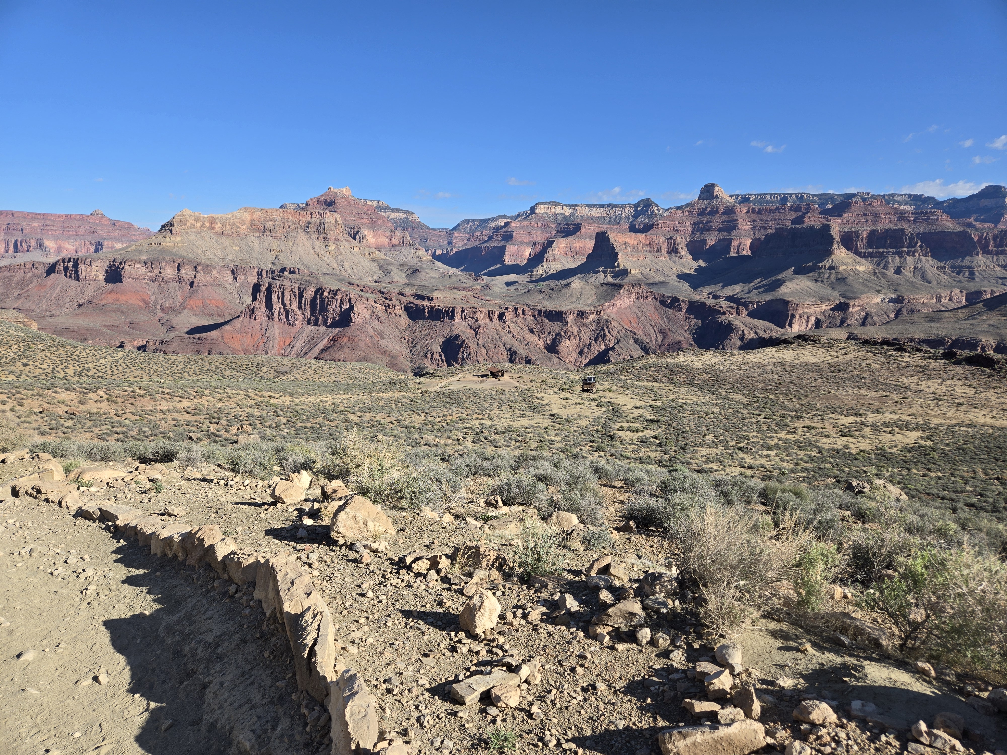
Tipoff Shelter
Finally they start back in high hopes. After all, how bad can it be. But now they realize it’s high noon in the Canyon. What started out as a cool, dry hike in he 70s when they started, is now a hike in the lower 90s with no shade. But at least it’s a dry heat, so they don’t feel gross and sweaty.
But now it’s uphill. And their legs are aching. Their snacks are running out. And their water, the surplus they thought they had when they got to Tipoff because they hadn’t even drunk half of it disappearing fast. It dawns on them that they’re now consuming three to four times as much water on the ascent as they did on the descent.
They get back upon the Butte and find a hint of shade here or there as the Sun moves westward, but eventually they realize that the shady last mile or so from the morning is now in the full view of the Sun. They start to panic when they take the last sip of water and realize the Rim is still a mile away and at their current pace, an hour more of brutally hot hiking.
Fortunately, like most hikers, they actually make it to the Rim safely. They stand in line refilling their water bottles and drinking down as much as they can. They’re a bit nauseous, but elated. They’ve seen one of the Wonders of the World. They’ve tested their limits more than they had expected But they’re here. They lived to talk about it. And hopefully they’ve learned a lesson: hiking in is easy and optional, hiking out is harder and mandatory.
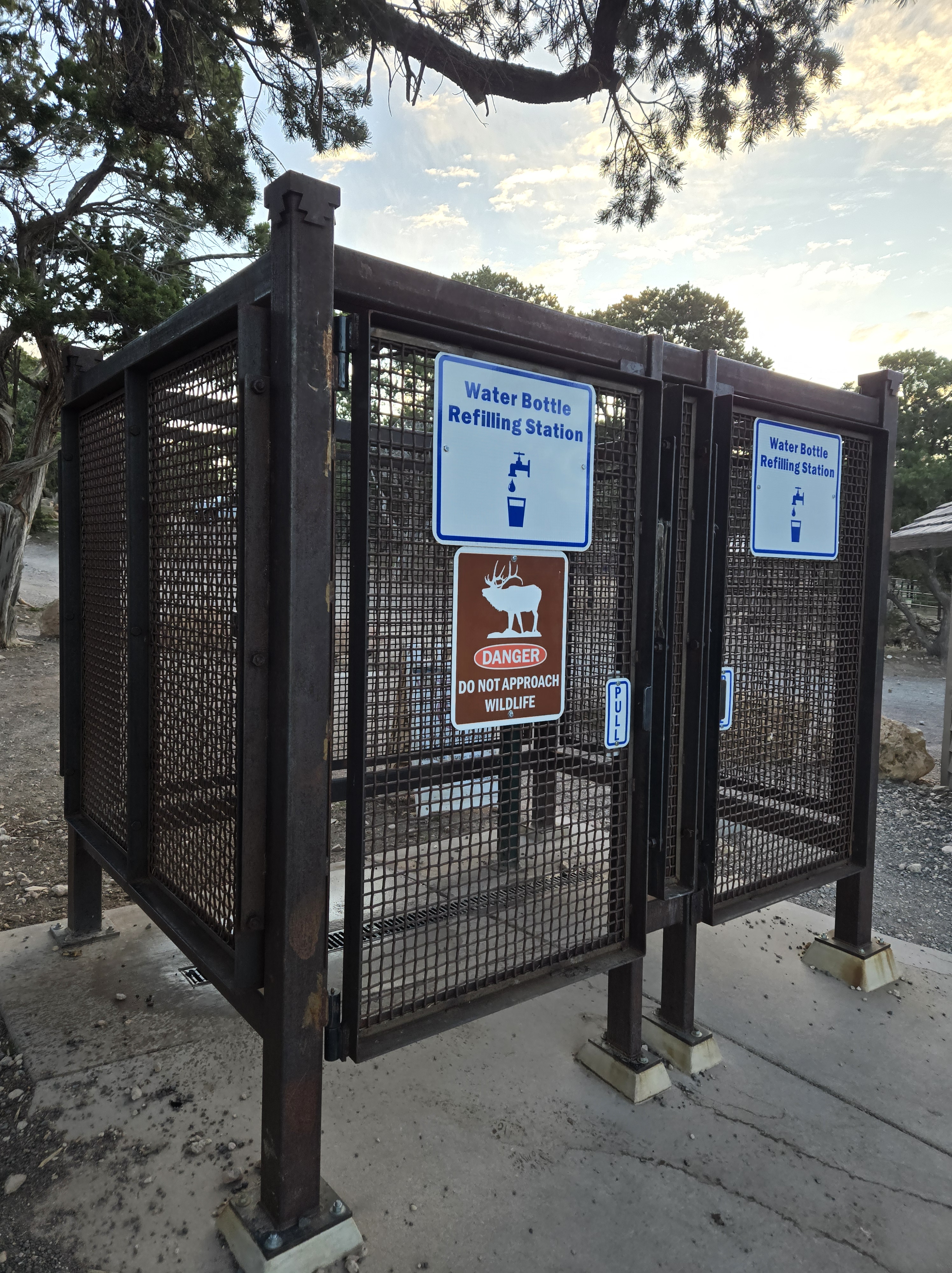
Water Station at the South Kaibab Trailhead
Why these thoughts? Honestly, I started this post with a different thread in mind, about how I’m approaching the end of the first year of PA school. But, my thoughts ended up taking a different path, and that has made all the difference. At least as far as this post goes.
I was reflecting earlier how the size of my “world” has changed over time.
When I was an infant, I didn’t know of a world beyond my crib. But as I got older, the world got bigger. While I have memories of going between Storrs and Falls Village CT, I think my first realization of a bigger world was when I followed some older boys in the housing complex in Storrs and ended up lost (I suspect they probably ditched me since who wants the 4yo following them around and ruining your fun when you’re 8 years old.) That ended up with a happy ending as a stranger found me and quite literally drove around asking if I recognized my apartment building. Apparently I did. I can’t imagine that scenario playing out today. That said, well before I can remember, my parents did do a trial move to California, but I don’t count that in my awareness, though I have a vague memory of me brushing my teeth while sitting on the tailgate of the Scout which I suspect was from one of the early road trips my dad and mom did.
When I was a bit older, I recall going to New York City with my parents and being confused because somehow I had gotten the idea that a city was bigger than a state and couldn’t figure out how New York City could be IN New York State. But even then, my world consisted mostly of trips to New Haven, CT to see my paternal grandparents and Bennington VT to see my maternal ones. And then there was the occasional trip to Boston to see my aunt and uncle (technically half-aunt, but there was never anything half about Aunt Sue).
At one point, I want to say when I was seven or so, I know I did a trip with my parents to Cape Code and to Bar Harbor ME. My world was getting bigger.
A few years later, a very different trip to Bar Harbor and then the Cape. That ended well but didn’t start so well.
Then a few years after that my world jumped in size. My dad and his then girlfriend and her daughter (four years my junior) and I travelled first to the Grand Canyon and Havasu Canyon. Suddenly I was outside the comfort of the northeast. And I loved it.
There were a few trips to Florida in there too, including my first time flying alone.
A few years after that I went to St. Croix USVI with my dad. My first long flight over water.
Years later I accompanied my paternal grandmother (my grandfather having passed on years previously) to the UK for my cousin’s wedding. Again, my world had expanded.
The NCRC has also helped expand my world due to having training all over the country.
And over the years, including this one, I have been back to the Grand Canyon three times since and have with the family seen much of the west coast, the Rockies and more.
And pre-Covid, the family and I visited the UK, France, and Belgium. My world continued to grow.
Going forward, I’m sure I’ll see more of the world.
And yet, in some ways, my world has shrunk and for a sad reason.
Other than a couple of brief trips to or through, I haven’t been to New Haven since my grandmother’s memorial.
I still go to Bennington, because my mom is there, but even then there’s a bit I don’t go to, my grandparent’s house. It’s no longer in the family since they’ve passed.
I’ll go to Boston again, but not as frequently since my aunt has died.
And I have yet to go back to Falls Village, ever since my closing out my dad’s estate. That one is just too hard, even years later.
You’ll note there’s a theme to the places I’m less likely to visit. And it’s one that I expect to become more common as I age.
So the world is bigger than ever and I’m still exploring it (as my spring road trip shows) but ironically in some ways, it’s grown a bit smaller. And that saddens me.
For some reason I found myself taking more pictures in bathrooms on my recent road trip than I think is healthy. So now I’ve decided to share my non-healthy apparent obsession with bathrooms.
The first one is from Ohio. It’s a sad state of affairs that such things are necessary at all. That said, I do have to wonder how many times these are accessed at rest stops along the Interstate. I suspect not often just because in most cases folks who are overdosing are in cities and towns. But overall, probably doesn’t cost much as a just in case measure.
These days I’m often surprised to see pay phones any place, let alone two of them. While strictly not a bathroom, this was at a rest stop. This was in Missouri.
At the same rest stop. Only one I’ve seen with a microwave. And honestly, the prices weren’t terrible for the microvable food in the vending machine. Had I not already eaten, I might have taken advantage of this.
Taken at a restaurant I ate dinner at in Texas. This was when I really knew I was in Texas!
I had mentioned how nice the rest stop/Visitor Center in Amarillo was. The bathroom itself was clean and had VERY tall ceilings. It was a bit weird, but kind of cool too.
This how I found the 1.5 Mile Rest House outhouse on the Bright Angel Trail. At about 3:00 AM in the morning. Seriously folks, do better!
From the Rim. From here you can’t tell what horrors await you when you step into the outhouse proper (as seen in the previous photo.)
Taken from teh same spot as the previous photo, but with the telephoto lens on my camera. This is beyond the 3x physical lens and includes “digital telephoto”. But I’m still very happy with it compared to my old phone!
This one is at Hover Dam. I took it for two reasons. For one, the unusual bowl shape. It recalls a woman’s urinal I once saw in a bathroom at West Hall at RPI. Yes, you read that right, a woman’s urinal. Far more practical (and apparently common) when women almost exclusively wore skirts or dresses. But this was the men’s urinal. Another factor that makes it interesting is the location. Along the edge of the top of the dam (where the original road crossing the Colorado was) there’s a walkway with some towers built in. One each contains a men’s and women’s bathroom. Interesting enough. More so, and the second reason I took the photo, because you have to go upstairs to access them (Hoover Dam built long before ADA bathrooms were a requirement). I was really hoping they had windows from the bathrooms overlooking the Colorado downstream but I was disappointed. No windows. But interesting urinals.
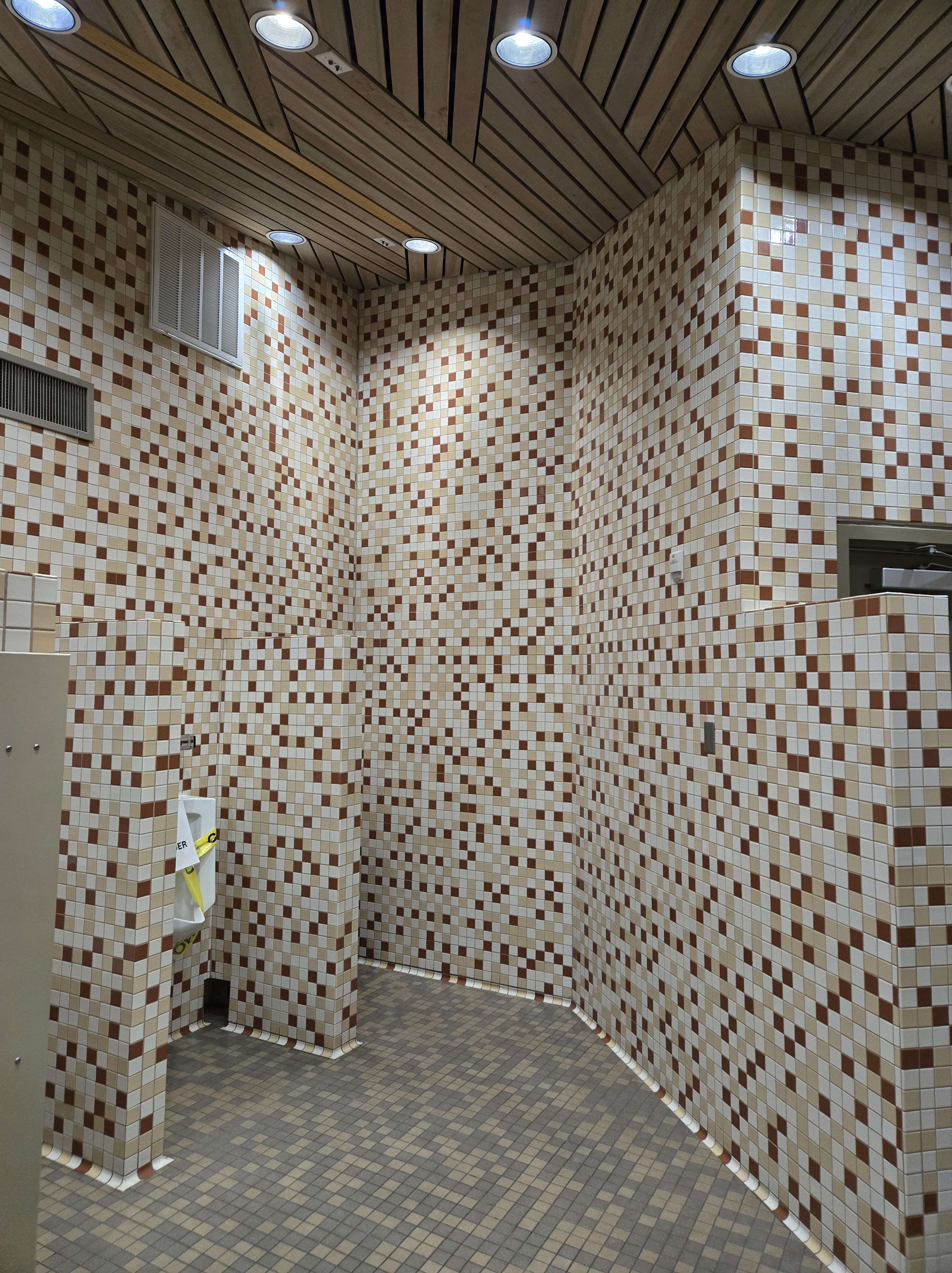
Seen at the Loop B restroom at Bryce Canyon. I mention Loop B because my camping spot was in Loo C. I was a little upset to discover the restroom at Loop C was closed for renovations. Loop B was far enough I drove over twice to use the restroom.
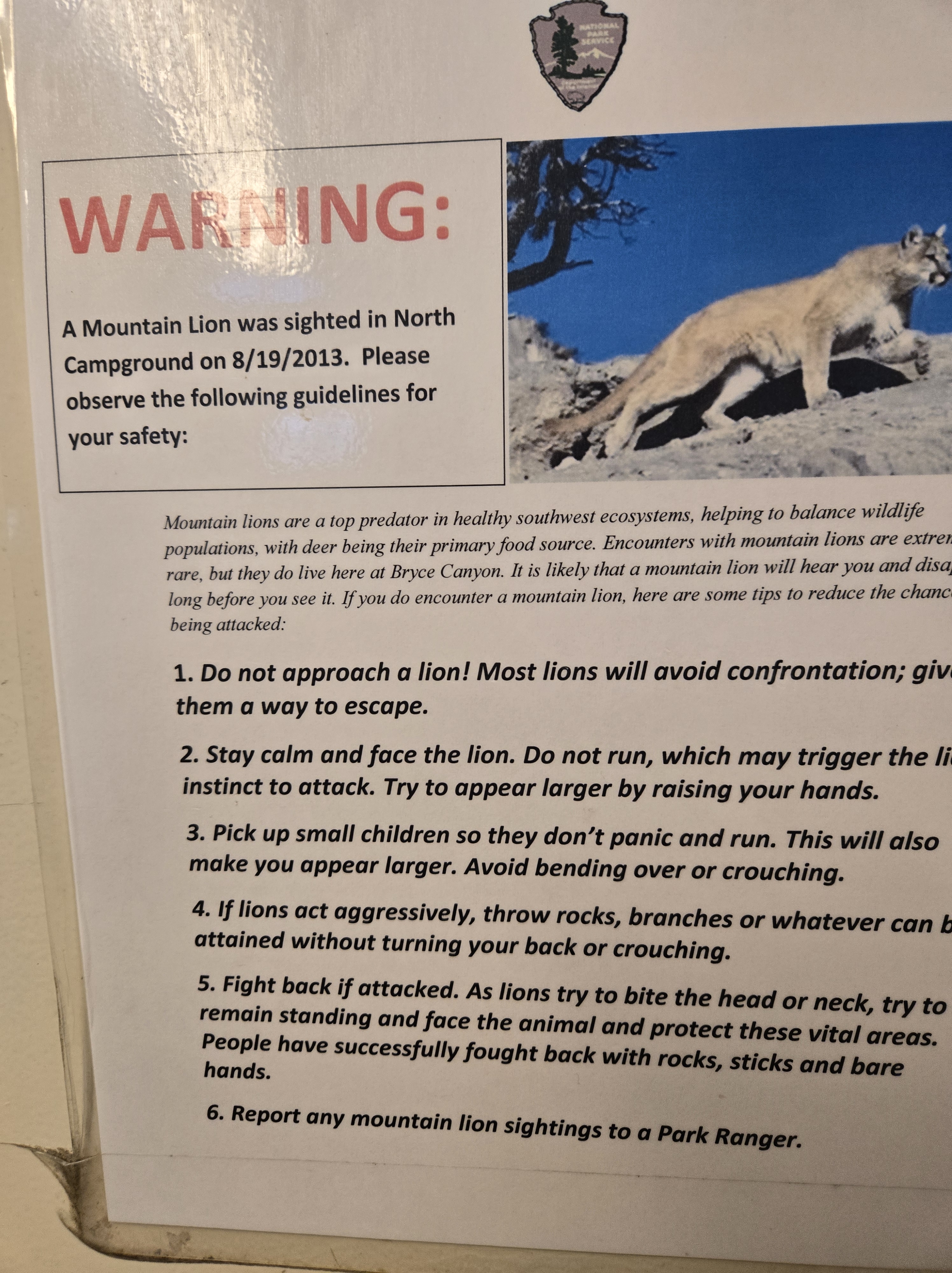
While I appreciate the warning, I do have to wonder if it’s still relevant and if so, perhaps they should update the sign a bit?
This was taken at the Meteor Crater Rest stop outside of Winslow Arizona. Also a very tall ceiling.
Spaceflight has shown that reentry is the most dangerous part of a flight. More people have died on re-entry than during launch. And even in uncrewed flights, there have been a lot of mishaps on reentry.
My reentry to normal life didn’t really have the risk of a fiery burn-up, though, had I not gotten enough sleep, a fire and crash was distinct personality.
After leaving my friend’s house I drove for another hour or two before getting some food and then eventually some sleep. I ended up pulling over at two separate rest stops to nap. The final time I woke up around 9:00 AM. I had hoped for an earlier start since I was still about 9 hours from home. But obviously my body needed the sleep.
There’s not much to report on the rest of the drive home other than I was struck by how green things were in the Northeast. Partly this was due to it being Spring and in the weeks I was gone a lot had bloomed. But also, I had been in the desert for so long which is a lot of reds and oranges and whites and grays, but very little green. The contrast was striking.
But the danger was a bit more subtle. It’s one thing to basically spend two weeks with no schedule and no responsibilities. It’s another to return those things. Here it is Saturday, and I’m still catching up. Laundry is done and half the car is unpacked. I’ve still got more to go. That said, it’s not like I haven’t been doing things. I spent most of yesterday dealing with paperwork related to starting school in a month.
And as strange as it sounds, Wednesday night/Thursday morning, I picked up a 4 hour “princess shift” in the Emergency Department from 3:00 AM to 7:00 AM. Based on the texts requesting help and looking at schedule, there were only 3 other techs scheduled so I knew they could use the help. I figured my sleep schedule was already messed up, so another late night/early morning wouldn’t be a problem. And honestly, it sort of helped me reenter my normal life.
At this point I have four regularly scheduled shifts left before I stop working as a .6 FTE tech. I will probably pick up one or two more during that time. But the time is quickly coming when I’ll be in that transition from working to schooling. I’ll have a couple of weeks to finish up projects around the house, sign a lease on a place in Delaware, and to move enough down there to setup housekeeping. So, my reentry is just a pause before the next journey. But I think I’m ready now.
I was making good time on my all night drive and with a few catnaps and a limited amount of caffeine (which really doesn’t tend to always help me I’ve discovered) I figured I’d make the Gateway Arch by Noon.
One stop along the way was the Will Rogers rest stop on the eastern side of Oklahoma.
Will Rogers Statue
Once I was in St. Louis I started to follow the Google Maps directions until I realized it was leading me away from the Arch. I’m still not quite sure where it thought I wanted to go, but after resetting it twice and being VERY specific the final time I was headed east towards the river. I had hoped to find a free spot along the side road I had parked when heading west, but the spots were full. I knew there was at least one garage that I could get my parking validated at, but I wasn’t sure which one it was so I choose the first available one that appeared to have fair pricing. I quickly parked. My watch told me it was just after 11:00 AM. I had made it before Noon!
Now I was fighting two timelines: first, I wanted to get to the ticket kiosk as quickly as possible so I could get the first available ticket, even if it meant the ticket was much later in the day. The second was, my bladder was beyond full!
I walked quickly to the entrance and went inside and turned to the ticket counter. Or rather, I turned to where the ticket counter had been literally a week and a half ago. Now it was completely boarded up with a sign, “Ticket Counter closed for renovations”. I was in a panic. All that driving for naught? Then I spied another sign with a QR Code that explained I could use the URL to purchase my ticket or go to another counter somewhere else in the visitor center and buy a ticket. I breathed a sigh of relief.
But my bladder now was screaming so that was my first order of business! After solving that I went back to the QR Code and scanned it. Turns out, that while the Reservations.gov website couldn’t provide me tickets on line, there is in fact an online site to buy them! This means I could have bought them the night before and taken my time driving here! Oh well. Such is life. The first available tickets were at 1:00 PM. Glancing at my watch I saw I had plenty of time. I bought my ticket and also received a discount because I’m a National Park Holder (still the best $80 I’ve spent in a long time). I then headed back to the car to swap into some cleaner clothing, put in my contacts and grab my National Parks passport so I could get it stamped. Then I headed back. I got my passport stamped and then headed through security to check out the displays while I waited for 1:00 PM to arrive.
On the way down I saw a monitor that showed boarding times and it said that the 1:00 PM ticketholders could start to board in 5 minutes. I thought this was a bit soon, but figured it might be a large crowd so I hurried. Then a thought crossed my mind. I glanced at my phone. It wasn’t 11:55 as my watch said, it was 12:55. Again I had passed time zones and forgotten to update my watch. No worries, I apparently had time and got in line.
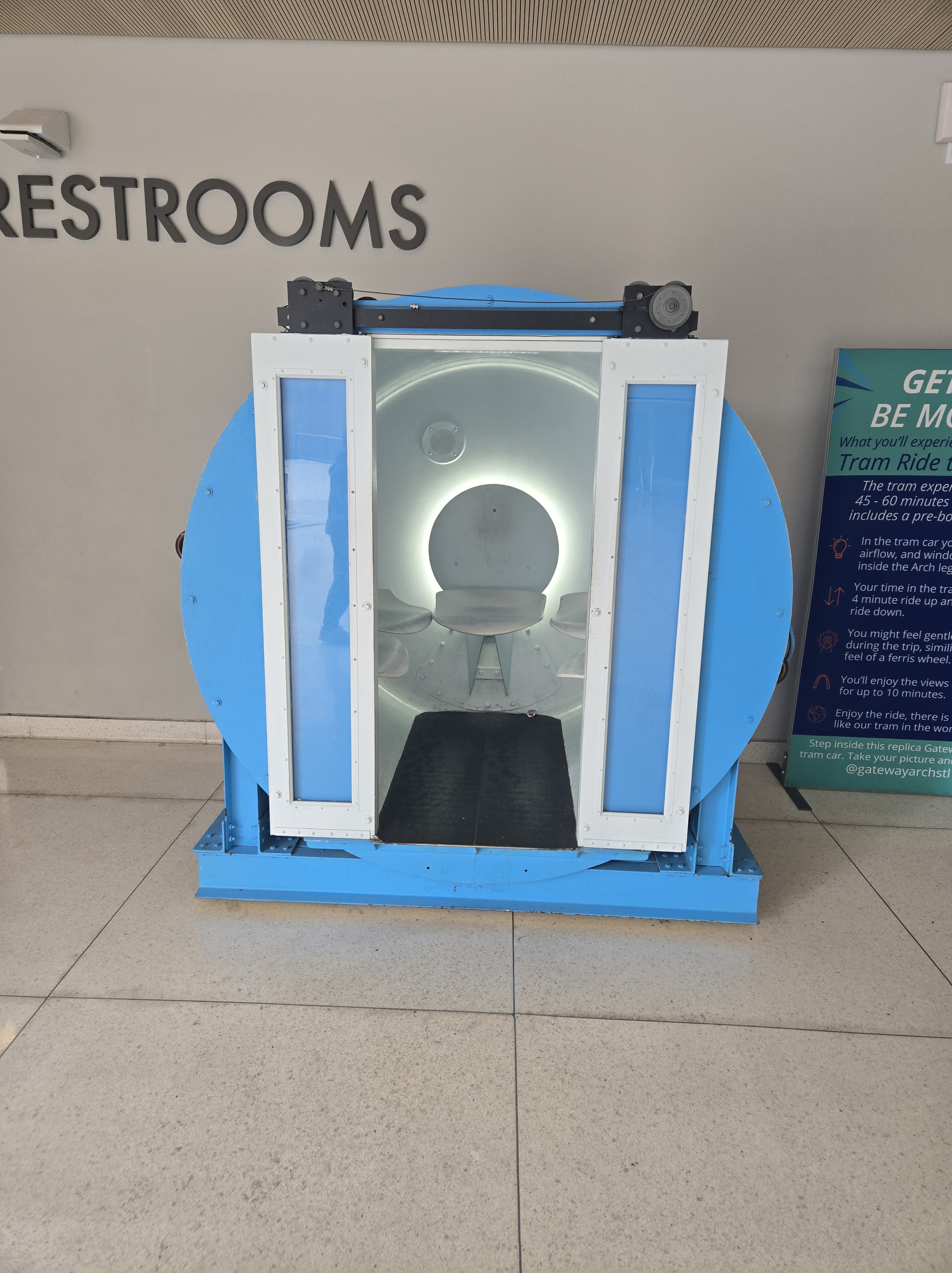
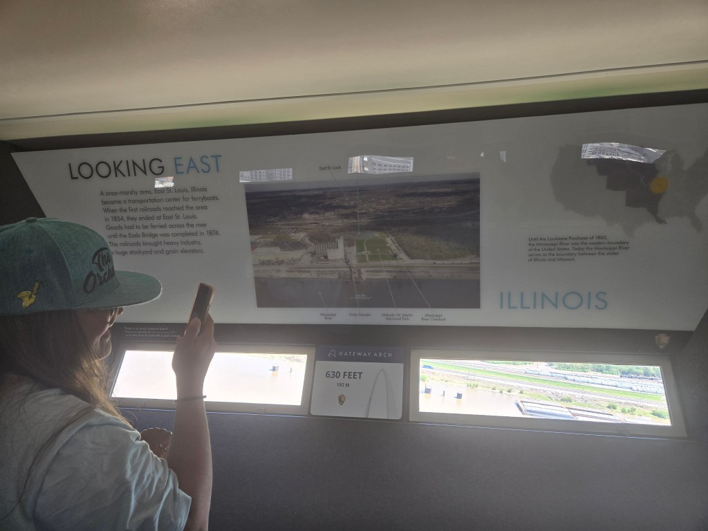
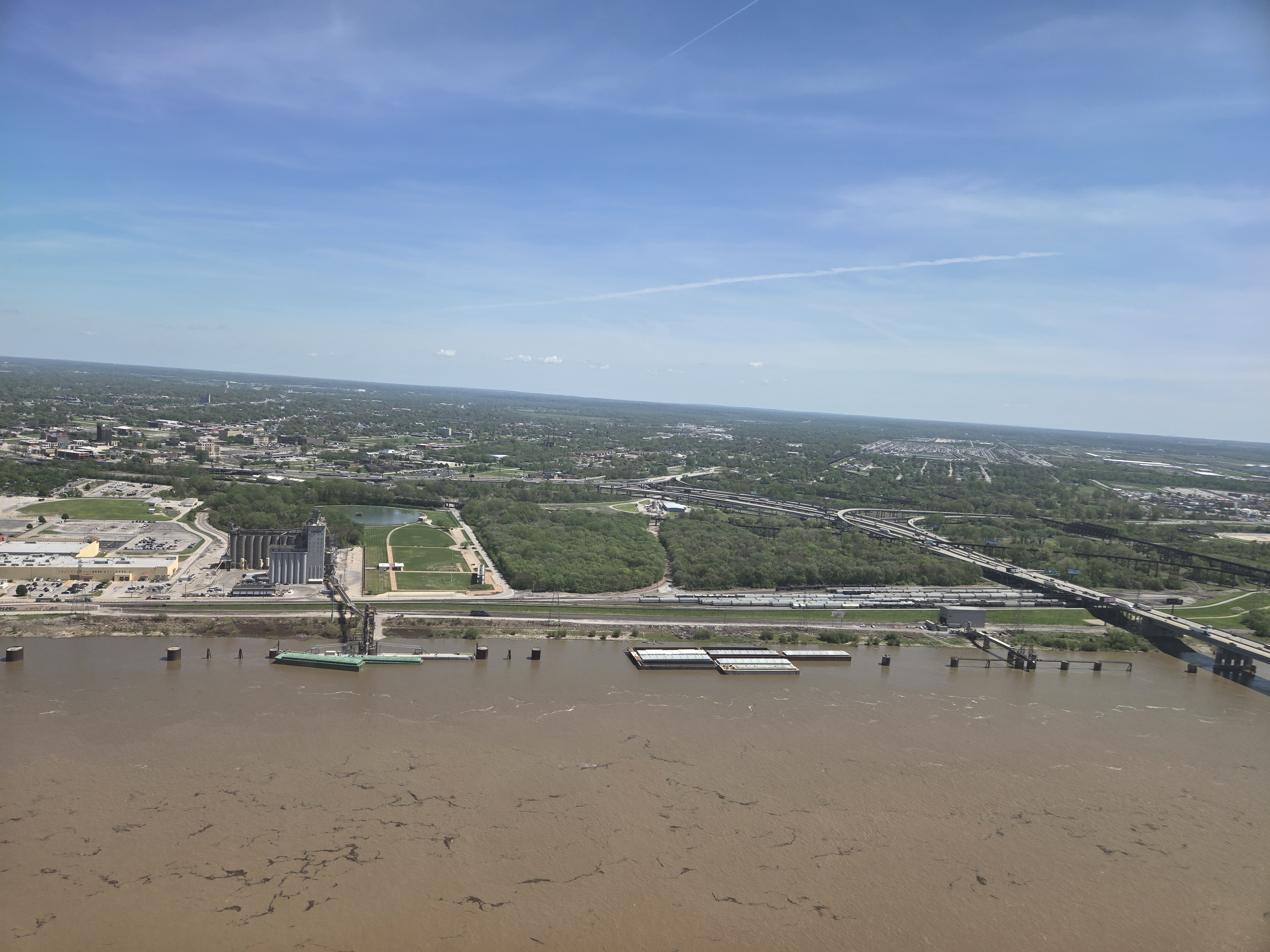
Turns out the line was far smaller than I expected. Here a little background on how one gets to the top of the Arch. As a video explains, because of the shape, a standard elevator wouldn’t work, nor would an escalator. The solution is basically 8 “cars” on a string that each sit in a ring with bearings. As the cars move up the Arch, they rotate so that the passengers are always upright. While I believe this is all done by gravity, I did notice that several times along the way up, the sound of a motor and the car righted itself a bit. I suspect there’s there’s both passive and active measures occurring.
Each car can hold 5 adults, but it’s a tight squeeze. So if you do the math, that’s 40 people per trip up. There’s one tram in each leg so that’s 80 people at a time when both are running (today only the North Tram was running). Given round-trip times, that’s 480 an hour.
Example of the car one rides to the top of the Arch.
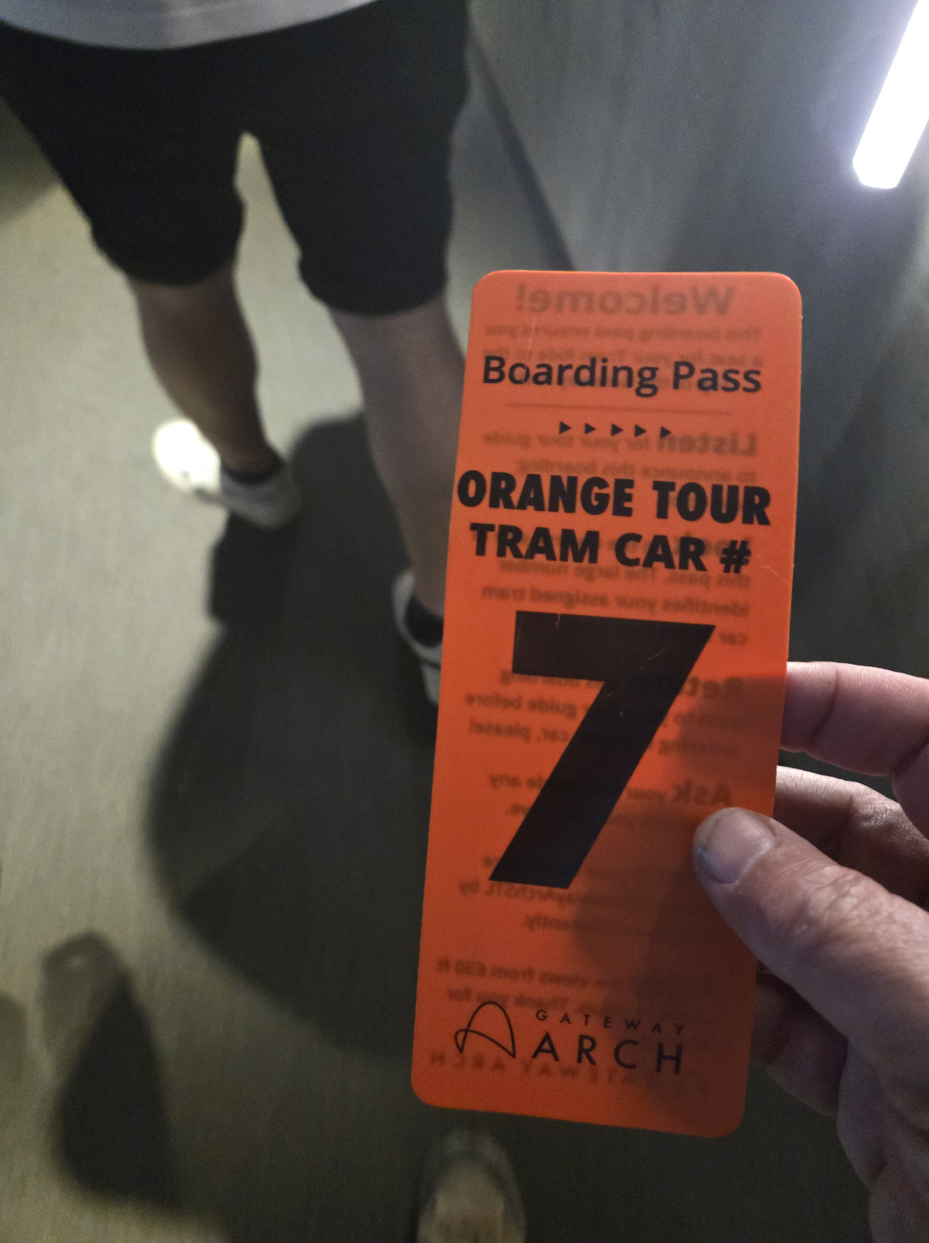
While in line, the guide asked who was in what groups and then handed out numbered boarding passes to indicate which car to board. I was number 7. In fact, I was the only in that particular car!
My ticket to ride
Before you board, there’s a short 1960s style animated video that’s actually a lot of fun to watch. It both made me feel old and nostalgic.
Then you line up in front of your particular car. They give you a safety briefing. The main details are the doors are only 4′ tall so duck when you enter and do not try to take photos as you enter.
Once boarded and the doors close you start to move up. It’s not obvious from the photos, but first you move to what would be the left of the photos above and then up and then as you move up, to the right (technically I was in the North Tram, so first you move to the North, then up and to the South)
There’s a window in the door so you can see the structure of the Arch, including the stairs of the 1,076 step emergency evacuation staircase.
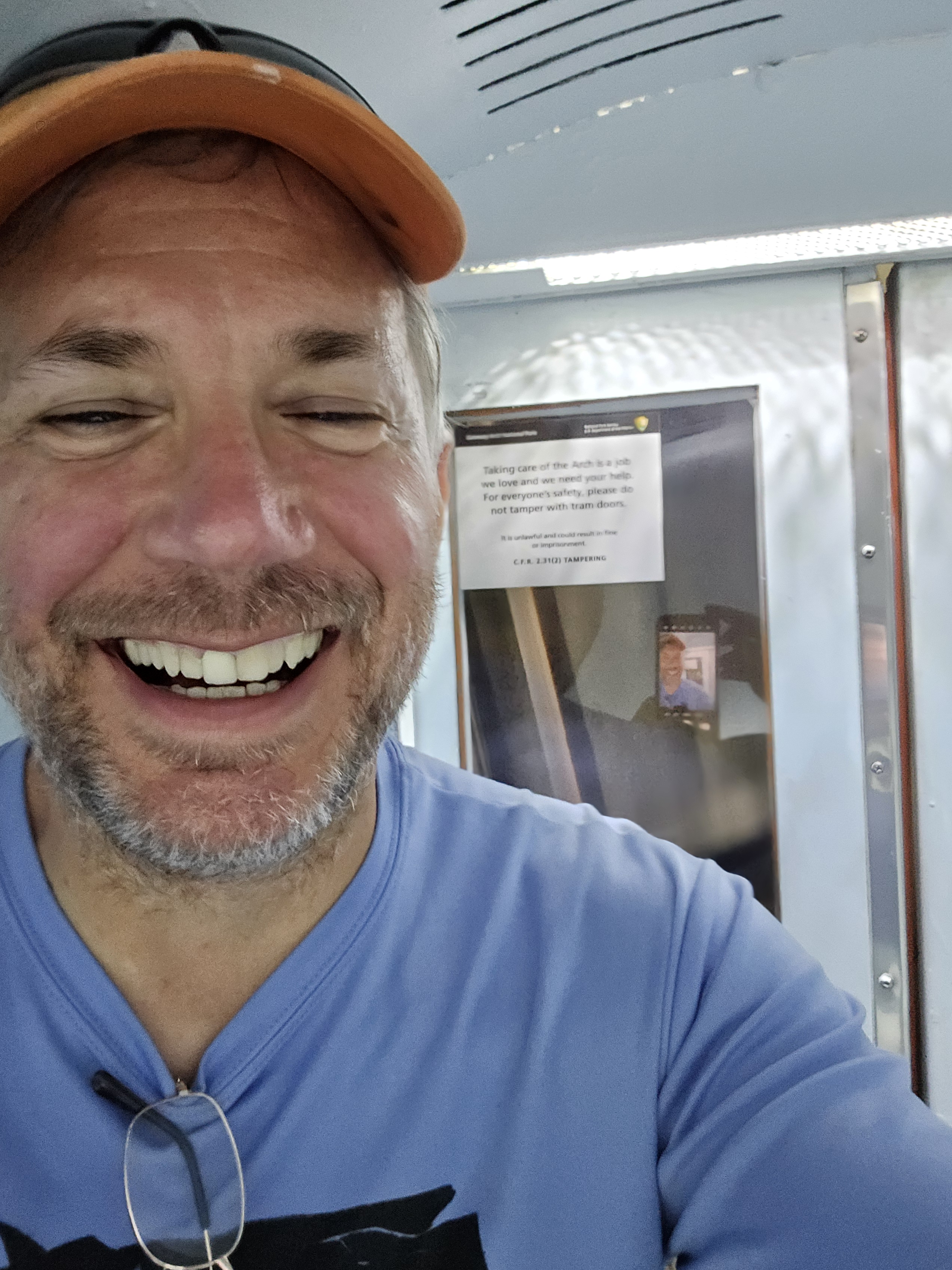
Yes, I was grinning Cheshire cat the entire way up. A dream of a lifetime was coming true.
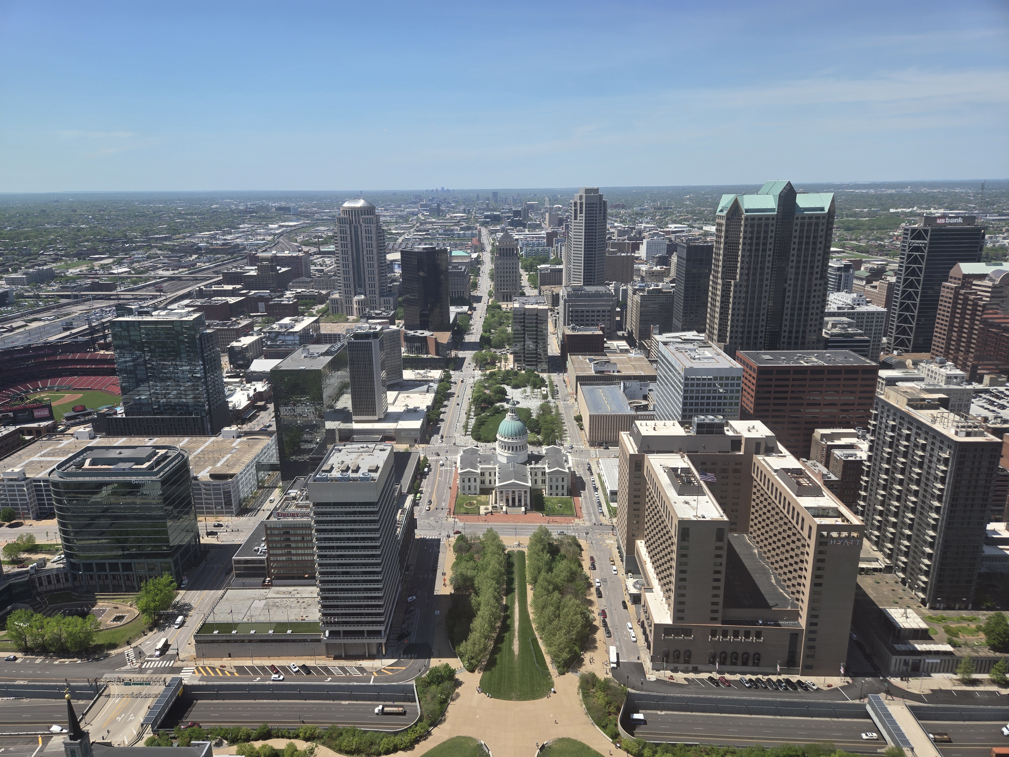
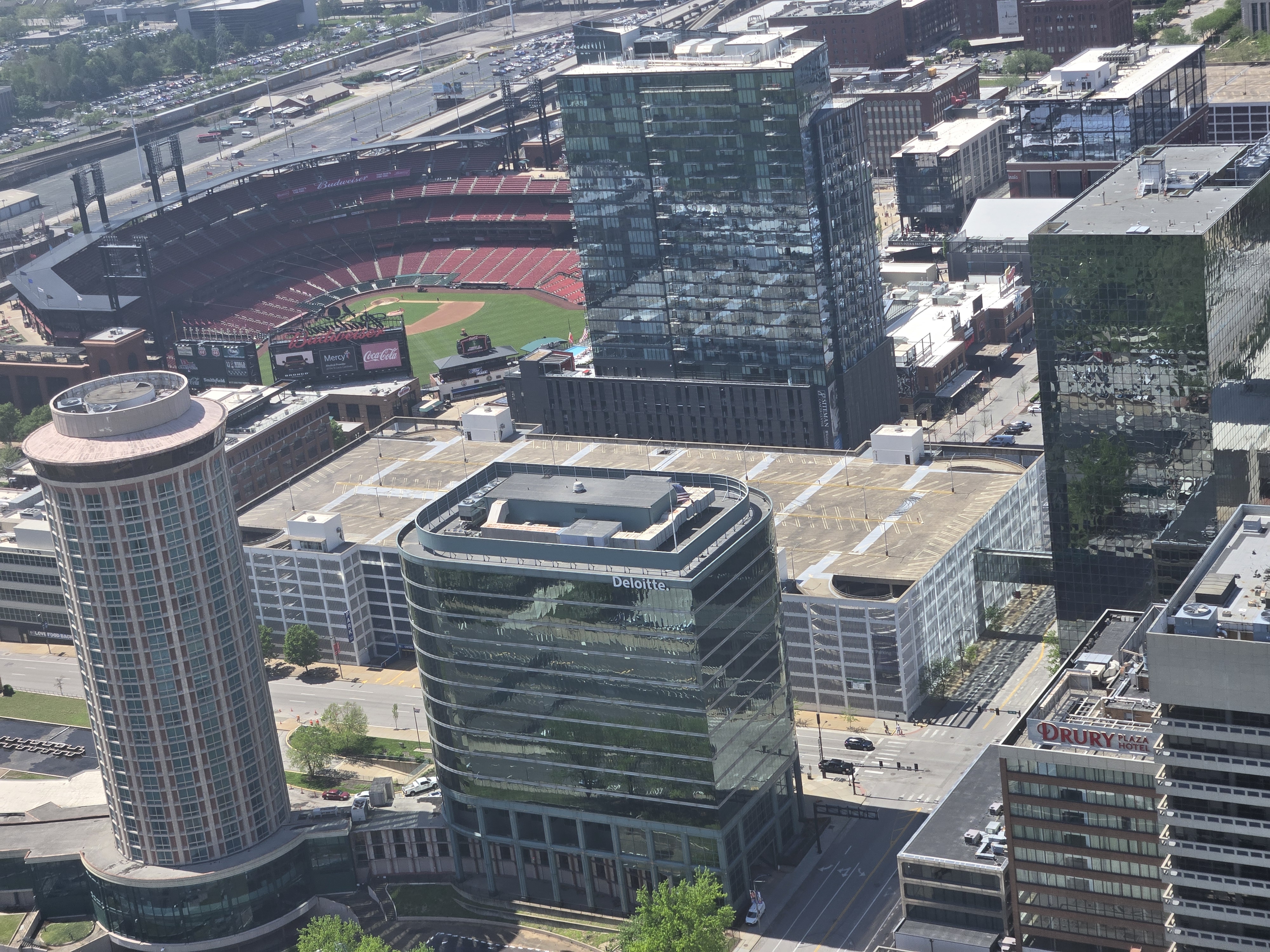
The top did not disappoint. I knew the observation windows were only 9″ tall so I thought it would be a tight view. I also had thought the observation area would be much smaller than it actually is. From the ground you get a false sense of scale. It’s actually fairly roomy (though I suspect with two full trams working and 80 people being up there it would be a bit crowded. All told we had perhaps 30 people including employees up there).
The ride up is about 4 minutes and the ride down is about 3 minutes. This with 3 minutes of time to board at the bottom means you’re given about 10 minutes to see everything. I thought I would feel rushed, but I wasn’t. Finally it was time to head back down.
After the ride down I visited the gift shop and then started to head out. I had been texting a friend about a quick visit and wanted to get there in time.
This said friend is someone I’ve known for over two decades now and is somewhat a mentor to me in the cave rescue community. I knew he’s definitely a mentor to another close friend of mine. Sadly though, said mentor was diagnosed with cancer several years ago and it has now since metastasized to his liver. He texted back that he’d probably be up for a visit after his hospice nurse left. Home hospice… that’s where he’s at now. That said, as he reminded me when we did talk in person, Jimmy Carter was on hospice for three years, so who knows how much time is left.
After leaving the Arch I headed to his place. I hoped to make it not too late as I didn’t want to keep him up late. It seemed fate had other ideas. Immediately upon entering Indiana I hit a detour as we were routed around a traffic accident. Or rather, routed off the Interstate onto a side road with no clear directions on where to go from there, so we all followed our GPSs or Google Maps which took us back onto the same Interstate albeit one exit later. This did put me ahead of some of the vehicles which had not been detoured, but didn’t help much. So this put me behind schedule.
Finally Google maps directed me off the Interstate onto the backroads to get to my friend’s house. However, Google maps didn’t know that immediately after turning off the Interstate that the road I was supposed to take was closed and I had to follow a detour. This further put me behind schedule.
Then, not more than 3 miles from my friend’s house, the Low Oil light came on. I’ve had enough Subarus to know that inevitably this is due to burning a bit of oil, not a sudden oil leak. So I pulled over, put some spare oil I carry with me for this purpose in and continued. Honestly, I had sort of expected this and should have checked my oil earlier. I had put in over 6000 miles in the last two weeks at this point.
I finally arrived at said friend’s house and he met me at the door. We sat and talked for over an hour. I’ll admit it was a bit bittersweet. We talked a bit about his prognosis and time left, but focused mostly on the good times we’ve had. Besides both being cavers, we have an interest in train travel and have travelled extensively via Amtrak.
In most cases when we talk to folks, we expect to see them again, but we both knew, even if we didn’t exactly say it out loud, that this might be our last chance to catch up.
That said, he’s not really bitter or sad. He’s led a great life and he’s been the person I expect he’s wanted to be. There’s an outside chance I’ll see him this summer if we both make it to the NSS Convention in New York, but honestly we both know that’s unlikely.
So, while I reached a new high this day, I also have poignant and bittersweet memories. I’m glad I made the stop. Ironically, had I bought tickets online for the Gateway Arch for later in the day and gotten sleep on my drive there, instead of a marathon all night drive, I would not have had a chance to catch up. That was the other reason I had done the marathon drive, even if somehow I didn’t make the top of the Arch, I knew it gave me a chance to meet with my friend. So the lack of sleep was worth it in multiple ways.
So, I don’t want to end this on a down note as much as a happy note. I reached a life goal and I caught up with a close friend. It was as they say, a good day.
I had taken off enough time for work that in theory I could be gone for 3 full weeks if I wanted. I hadn’t made formal plans beyond trying to hike in the Grand Canyon and that was already several days behind me. Leaving Bryce I had two choices, head back south and try to check out a few spots I had missed, or head north and visit some friends and possibly more national parks. Had I gone north, I most likely would have checked out Rocky Mountain National Park and perhaps back to Yellowstone and more.
But honestly, I was getting a bit homesick and I knew heading north would get me into colder weather. I had brought the gear for that, so it wasn’t a real issue, but it was something to consider.
I had wrestled the night before and that morning what to do. I didn’t have a camping reservation any place, which concerned me. As the previous post notes, I had headed south and fortunately found a great spot to camp.
I slept that night under the starts and woke up several times and saw how they had moved over the course of the night. Finally morning came and I packed up and got moving. The idea was to start by checking out the Glen Canyon Dam Visitor center (and to fill up on water, since this primitive camp ground had no water supply). I thought it opened at 8:00 AM but when I got there I saw it opened at 9:00 AM. No worries, I could wait. 9:00 AM came and went and they didn’t open. Several other people tried the door. Suddenly I realized what had happened. Despite passing back into Arizona, my phone (and presumably the phones of the others) had NOT shifted back to Mountain Standard Time. This actually surprised me because, as I later confirmed, generally both my car and phone were very good (as in a matter of maybe 100 meters or so) of updating when changing time zones. I knew from previous experience my phone adapted correctly to Arizona not being in Daylight Saving time. So why it didn’t this time, I’m not sure. Anyway, we all waited another hour for 9:00 AM Arizona time to arrive.
Whereas I’m not entirely convinced Hoover Dam was worth the price of the tour (especially since the visitor center proper there was closed for renovations), I do feel Glen Canyon Dam was worth the price. It was free. There’s definitely far less to see here. There’s no tour of the dam. Fewer viewpoints. But there’s a decent enough amount of things to look at and learn from. I spent perhaps an hour there and then headed out. I had a plan. The plan required a lot of driving. Giving I was starting an hour later than I had expected, that plan was already in jeopardy.
But that said, I did make a stop for some more photographs of what’s essentially the upstream end of the Grand Canyon. I have now seen basically both “ends” (technically the Grand Canyon ends at the start of Lake Mead, but I’m counting the two dams/lakes as the start/end of the Grand Canyon.)
I then saw a sign for Horseshoe Bend viewpoint. This is a famous bend in the river I wanted to get some pictures from. I pulled off, only to see a sign that there was a $10 entry fee and that since it’s not part of the National Park System, they don’t accept the pass I had. By now I couldn’t turn around so I had to go to the ticket booth and tell her basically I just wanted to leave. She let me through and I did. While I’m all for capitalism, at $10 for what would have been perhaps 1.5 hours of my life, I just didn’t see the value. I had already hiked the Canyon itself and seen a lot, I could pass on this.
After leaving Page and heading south, I continued to pass through the desert and some canyons. It was beautiful. One stop I made along the way was a roadside “Frybread” place. I had been meaning to try some of what’s considered a local delicacy by the local Native Americans. When I pulled over, other than two other gringos, all the other customers looked to be Native American, so I figured I made a good choice. I ordered the “Taco Frybread”. I was pretty good. I’d definitely recommend trying frybread if you get a chance. Perhaps on its own just to get the full flavor.
After leaving there, my next goal was Meteor Crater. This was off of I-40 and I had passed by it on the way towards the Grand Canyon. It’s about 5 miles off of I-40. I had been under the impression it was also part of the National Park System. It’s not. I only discovered that after driving all the way there and getting to the ticket desk. While the $29 entry fee apparently included a guided tour and a movie, again I just decided it wasn’t worth it.
It was a combination and cost in both that case and the case of Horseshoe Curve. Had either been free, I might have taken the time. But combined, I decided not to take the time, especially since I had a plan.
The plan was to make a mad dash for the Gateway Arch and get there early enough to try to get tickets. This is not a plan I would normally recommend to most folks. I did the math and realized if I wanted to get to the Arch before Noon, it meant basically driving for close to 20 hours straight with just a few stops for gas, food, and very short cat-naps. My goal was Noon since on my way out when I had missed out on getting tickets, the gentleman explained that they had sold out that morning. I was hoping that on a Tuesday, they would be less likely to sell out so early.
So after leaving Meteor Crater, it was basically just driving, back over roads I had already driven. I did manage a quick pit stop again in Amarillo at the visitor center I had slept at on the way out. I think that was the only place I did a duplicate visit of.
By about 3 or 4 in the morning I was seriously questioning my life choices, but I kept soldiering on.
As I noted in my previous post, it was cold enough for frost inside the car. So I was a late riser. But after breakfast I packed up the car (which requires minimal work in this setup) and headed over to the “General Store” in Bryce. I had seen in the handout I had picked up that it had showers. So I figured I’d snag an early parking spot, explore the park, shower and then head out.
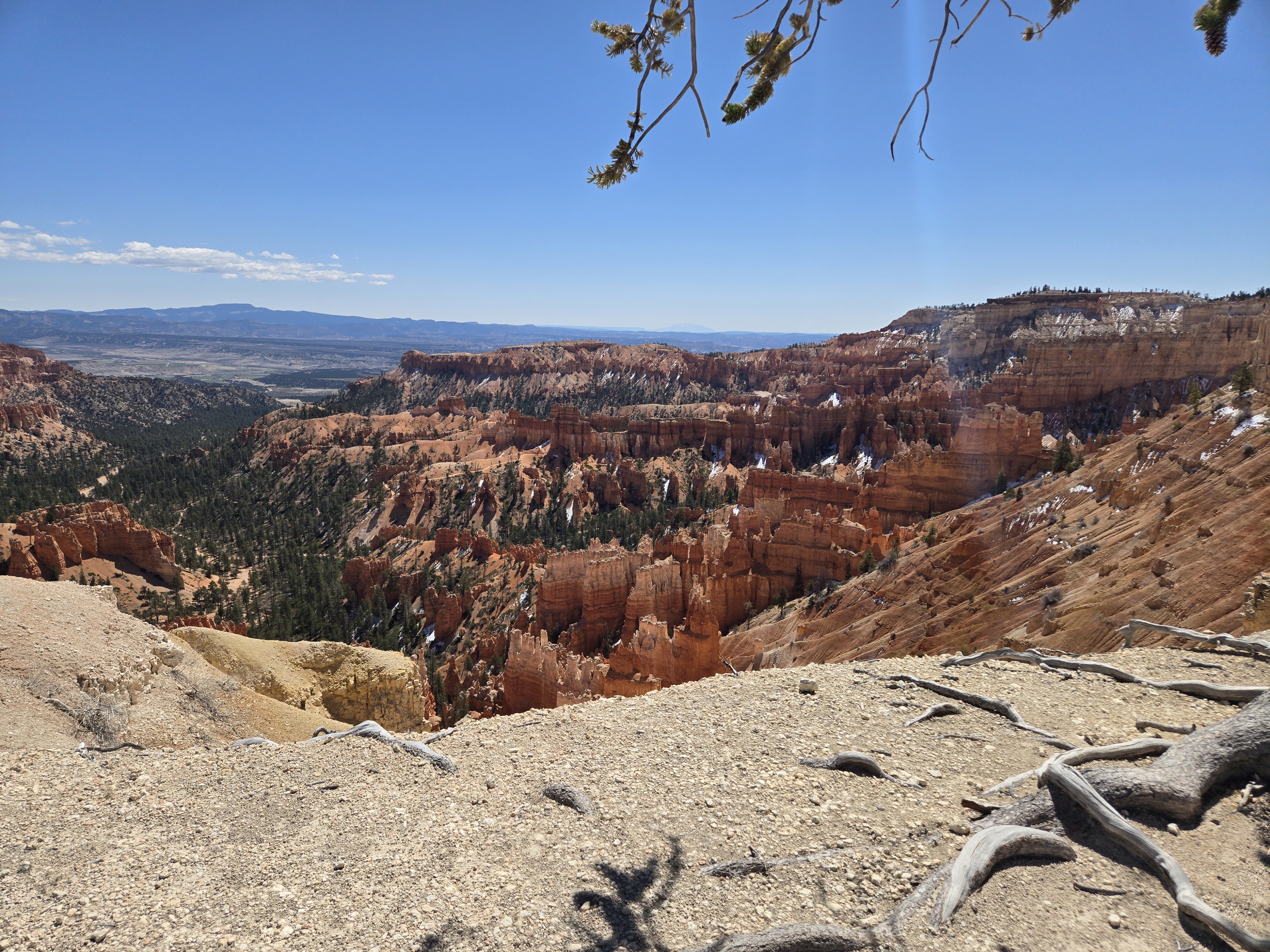
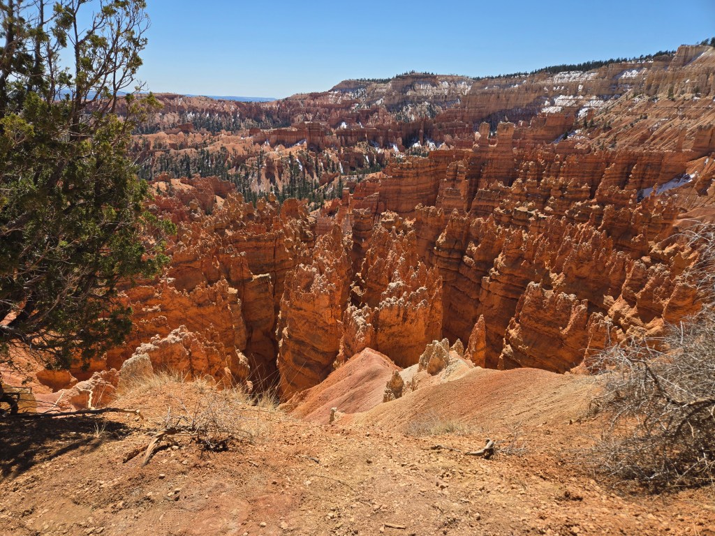
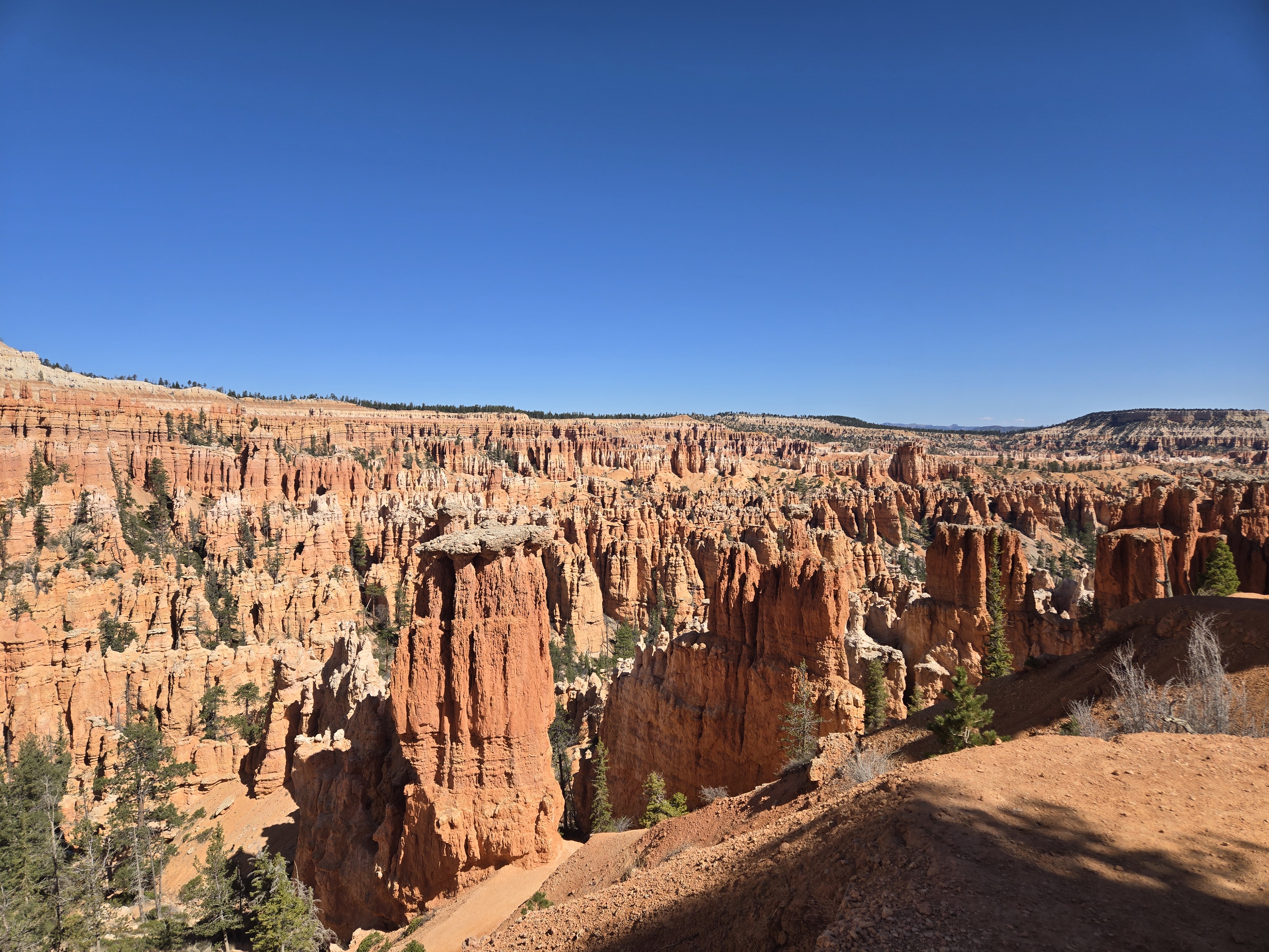
I wasn’t entirely sure what I’d do in Bryce and my first view of the “canyon” left me a bit underwhelmed. I’ll stop here a second to note that Bryce Canyon is a misnomer. It’s not carved by a river and really only has one rim. In fact the area I was in, which is often said to be the most beautiful section is actually called the Bryce Amphitheater.
That said, my next views corrected my initial impression. Bryce is amazing.
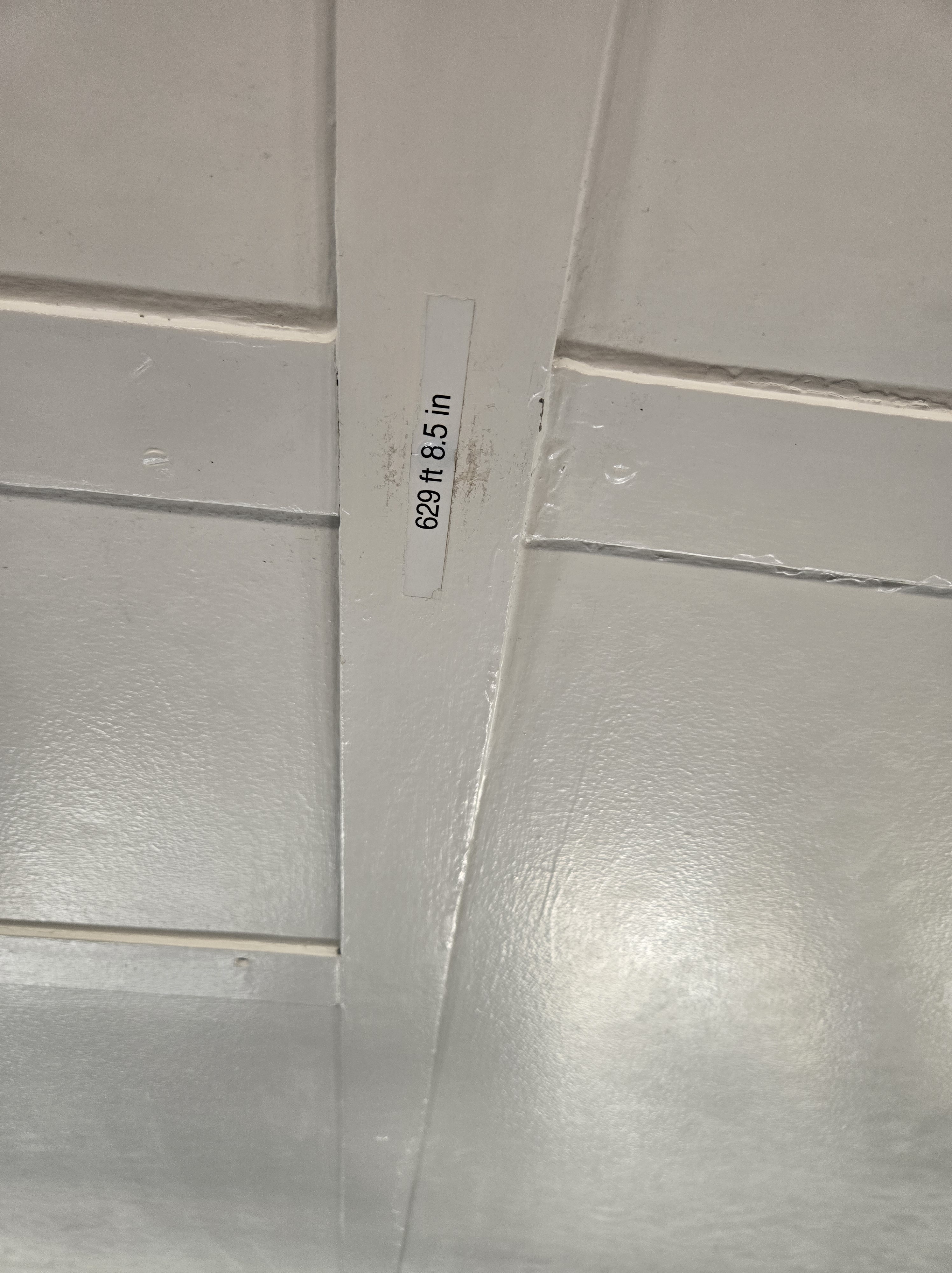
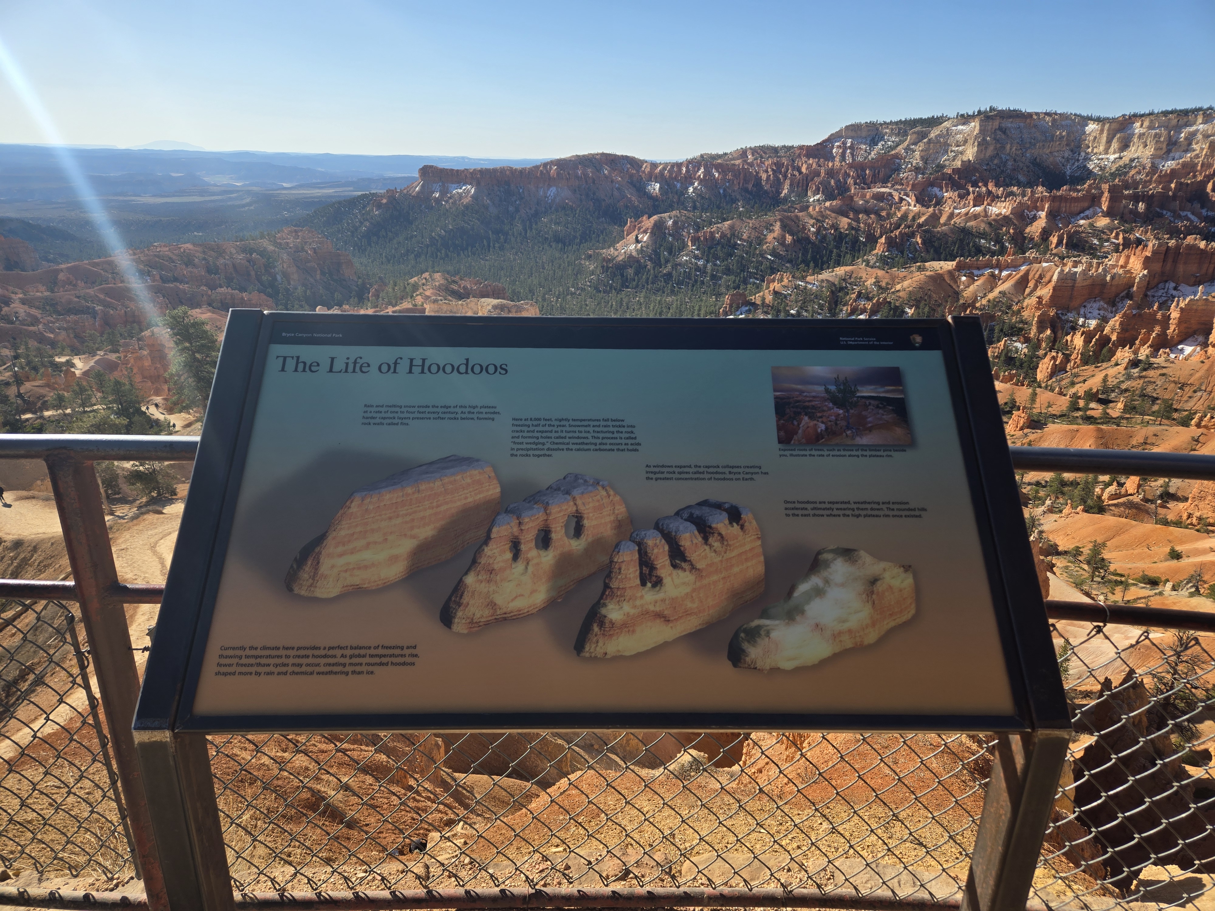
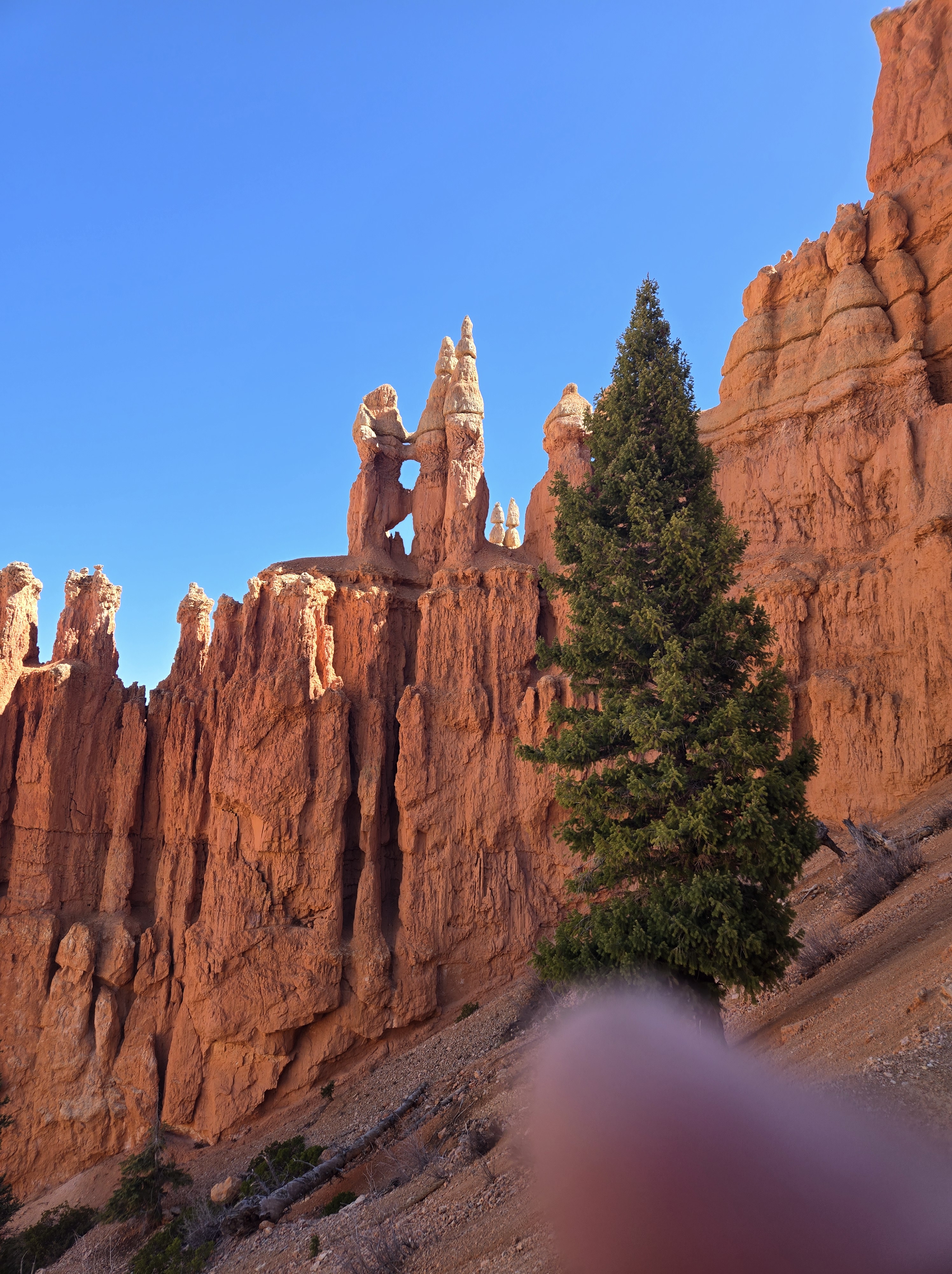
Bryce is known for what are called hoodoos. The pictures below give an idea of what they are, but one could call them water and wind eroded fingers of rock sticking up. Bryce claims to have the largest collection of them in a single area in the world. I’d believe it.
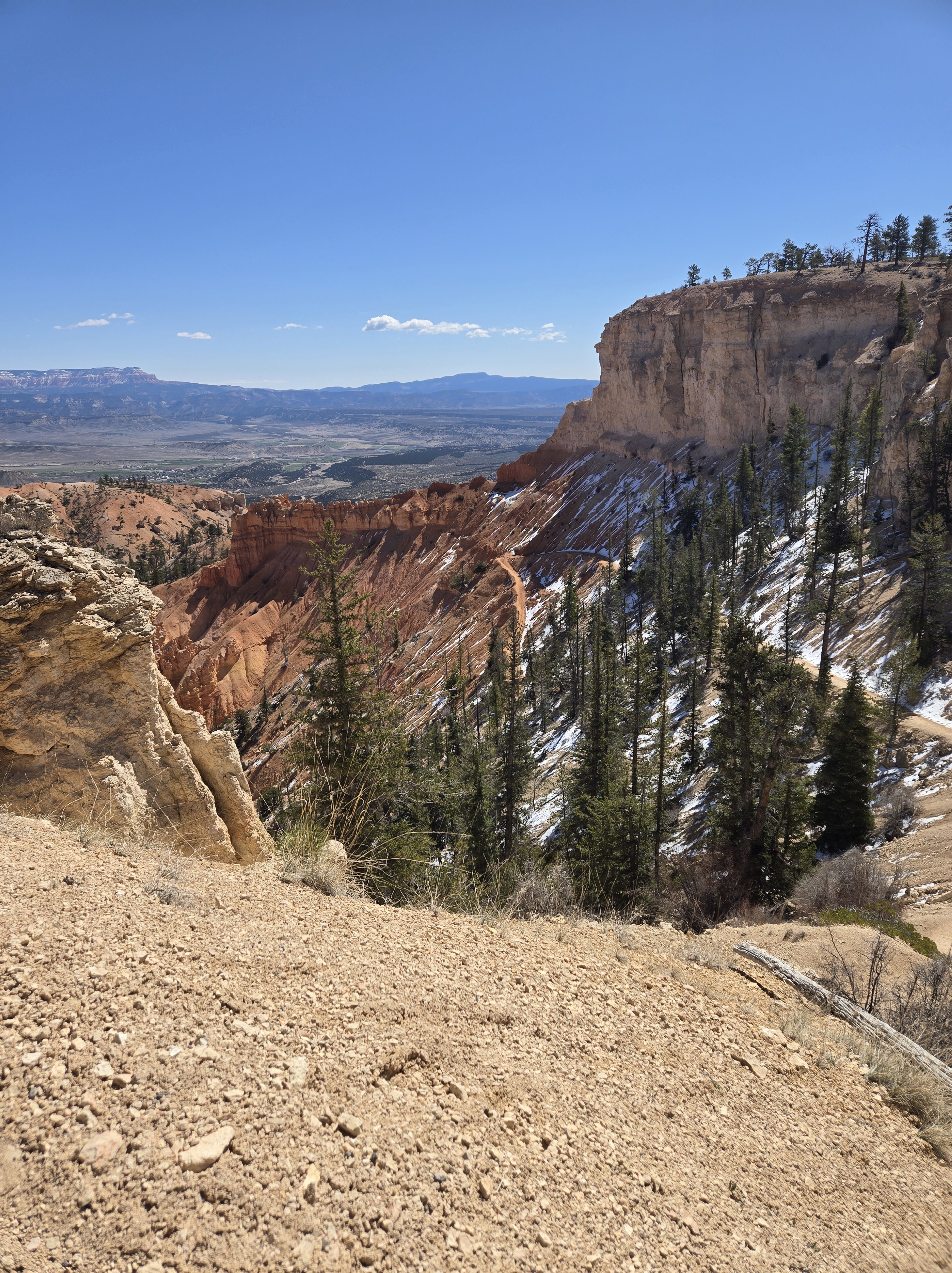
I’m a firm believer to really experience a park like this, you can’t see it from just the rim, but have to go down into it. So I did. I descended near Sunrise Point towards The Queen’s Garden. From there I continued to the junction with the Navajo Loop and then followed the Peekaboo Loop trail up to Bryce Point. A quote from the Apollo 10’s Gene Cernan as they were nine miles above the Moon’s surface and seeing everything in great detail kept coming to mind: “We is down among ‘em”. I was definitely down among the hoodoos. All told I did about 4.1 miles. It was well worth it. I started out all bundled up because of the cold, but partway through stripped off my upper outer layers to avoid overheating.
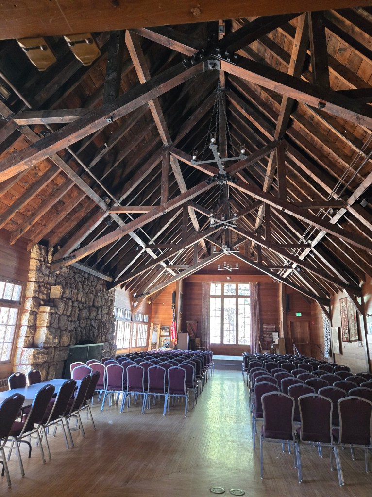
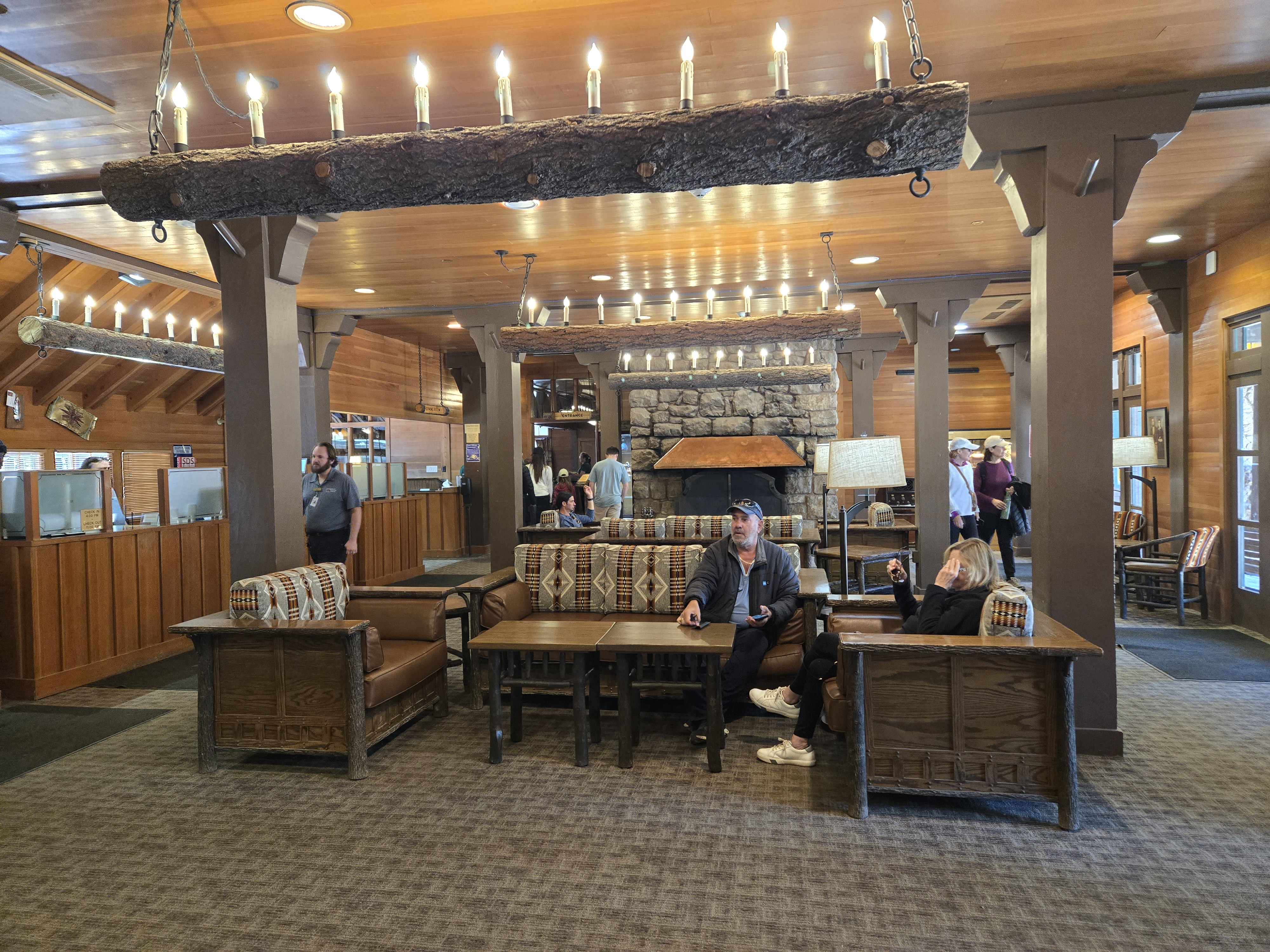
Once at Bryce Point I caught the shuttle to Inspiration Point. I got off there, got more photos of the Amphitheater and then reboarded the shuttle to the Bryce Canyon Lodge. I wanted to check it out and wasn’t disappointed. All the great National Parks have some really incredible architecture in their lodges.
From there I visited the Visitors Center and then headed back Sunset Point for a ranger led talk (in this case on birds of prey at Bryce. After that I wandered over to my car to get stuff to shower. It has been several days since my shower at the Grand Canyon and may be my last chance before I get home. This was a better deal. $3 for 8 minutes versus $2.50 for 5 minutes at the Grand Canyon.
I headed back to the Visitors Center to refill some water (and after getting on the road and tasting it realizing I should have swapped some my less tasty water for more of the Bryce water. It’s probably the best water I’ve tasted yet in the parks on this trip.)
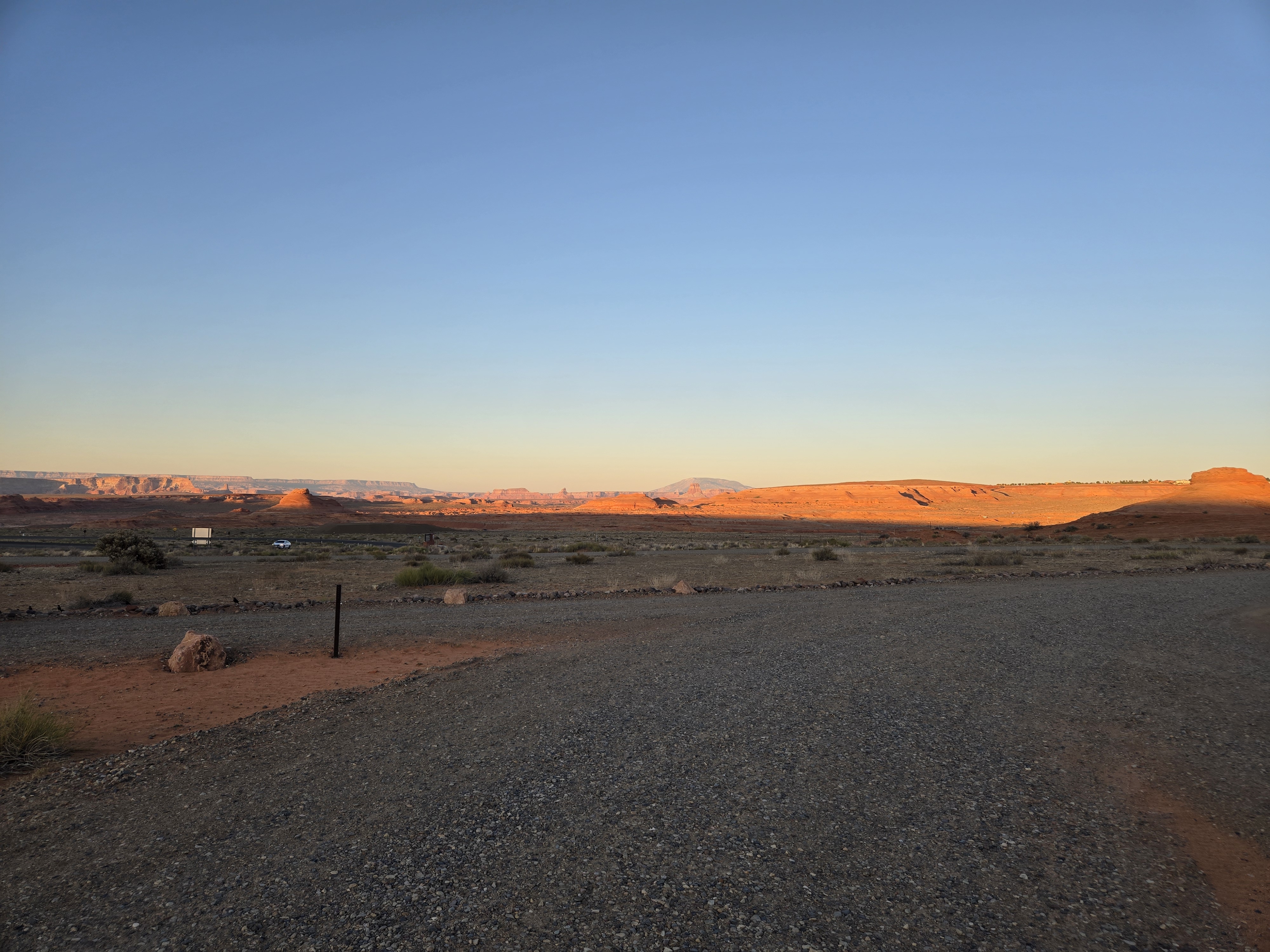
After that, I honestly wasn’t sure where I was staying. I decided to head towards Page, Arizona and check out Glen Canyon Dam and Lake Powell and hope to snag a spot in a campground there. Frustratingly, I had finally gotten around to downloading the Reservations.Gov app while on the Bryce Canyon Visitor Center’s Wi-Fi, but it wasn’t working well to actually show me available dates. So after arriving at the closed (due to my lateness) Glen Canyon Dam Visitor’s Center and taking some photos I removed the app and tried again. Just about 1 mile away was Beehive Campground which is a primitive site (i.e. no running water). I figured I’d check it out. I lucked out. There were two available sites left. So after self-registering, I set out to make some dinner and catch up on journalling.
Interesting enough, because there’s no trees here and I’m overlooking Lake Powell, I’d say it’s perhaps one of the prettiest sites I’ve camped at yet.
And now to clean up and set up for bed and see what tomorrow brings.
One of my goals on this trip (yes, this road trip has goals, albeit not set in stone ones) was to visit Zion and Bryce. As noted in a previous post, I had postponed them by a day do to the cold went to Death Valley instead. But now it was time to finally hit them up.
One of the ongoing issues I kept having was the lack of available camping at Zion. It normally has two campgrounds but one is closed for refurbishment. So despite checking daily, I had no lucking securing a campsite. This meant at best I could do a day visit and then hurry over to Zion for a camping site. It was doable but less than ideal.
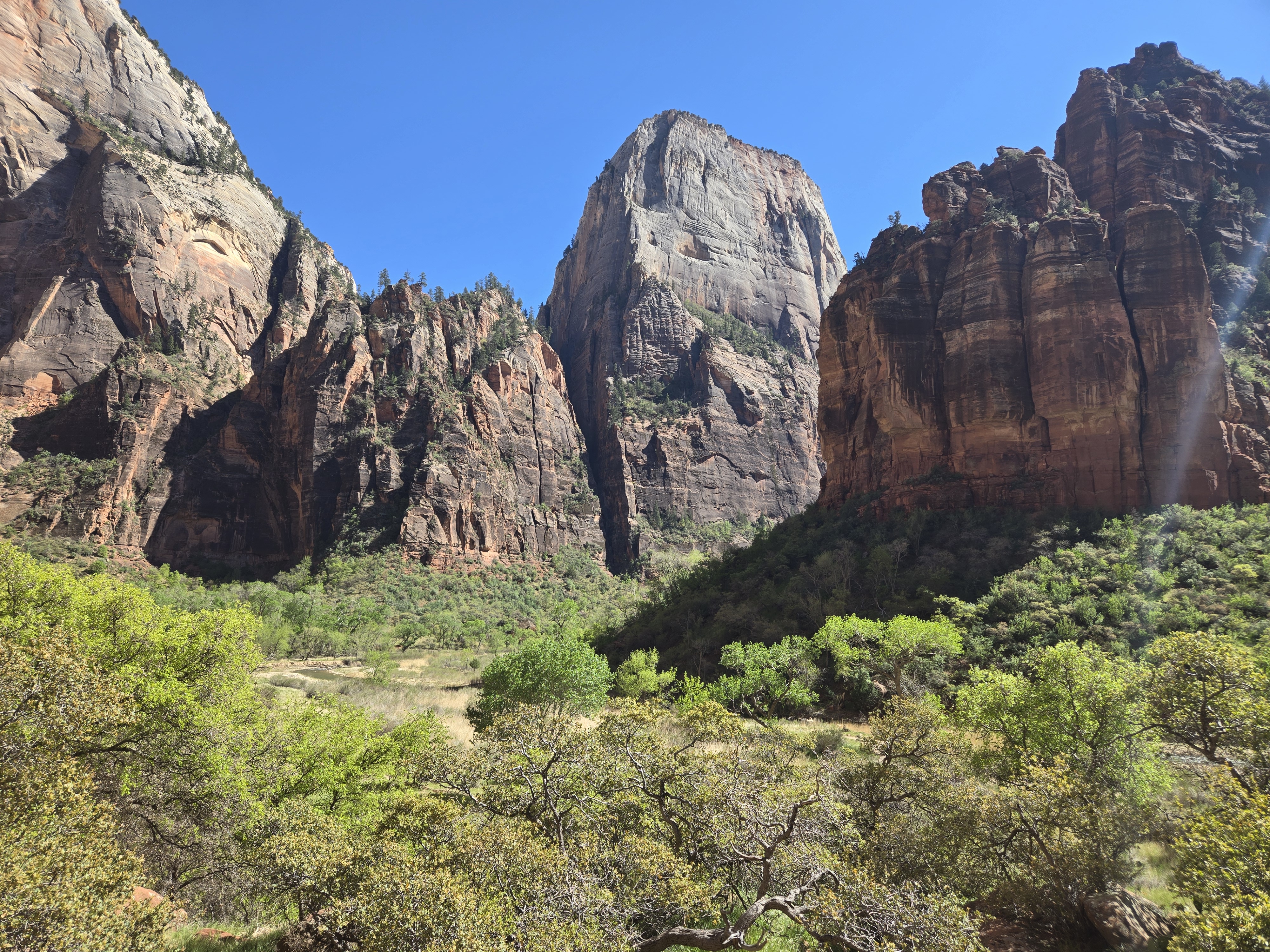
I was fortunate enough to get a spot at the visitor center. Failure to do so would have required me to backtrack into town and catch the visitor center shuttle into the park. After checking out the visitor center, I boarded the in-park shuttle to go up to the top of the road into Zion Canyon. Once there I did what everyone else did and hiked upstream on the dry path until I hit the water itself and turned around. While the trail does continue, and I’d say is probably worth it, I really didn’t want to deal with wet feet. I then caught the shuttle back down and hopped off at a couple of stops and walked between a few so I could get more hiking in and more pictures. I caught a shuttle back to the visitor center. On the way it stopped by the museum where the bus driver pointed out we had 1 whole minute to catch the museum before it closed. Now I’m going to commit heresy, but I’ll be honest: Zion wasn’t my favorite park so far. I’ll admit to failing to give it a full shot and there are other parts to see, but honestly, while still very pretty and impressive, I’m not sure I’d rush to go back. It also struck me in some ways as one of the more crowded parks. I suspect that’s because probably a very high percentage of the visitors are all crowded into the one main canyon. There are other parts to visit and I intend to someday. Perhaps I’ll enjoy it more.
From there it was time to head east. Now this road is impressive. It has some incredible views and even if you do nothing else in Zion, I’d say this drive is worth it. Included in the drive is passage through a 1 mile long tunnel. My dad would have hated it. He had an irrational fear of tunnels. By his own admission. I recall our drive across the country when it turned out we had to go through some tunnels on the Pennsylvania Turnpike. He was white-knuckled.
One detail that makes these tunnels interesting is along the north side are 3 large “windows” in the rock that open up over the valley. You can’t stop to look out, but you do pass them. You may have come across a click-bait article that talks about the “mysterious windows in the rock in Zion Canyon”. Well there’s no mystery. They’re openings into this road tunnel.
Eventually the road opens up into wide open spaces and from there it’s a pretty, but also somewhat non-noteworthy drive into Bryce. Since I got there after hours no one was at the gate to greet me (which is fine because my Park Pass would have covered the entrance fee). I got to my campsite. Well, the slight pull-off from the paved loop that was called my campsite. I literally had to make sure my passenger door wasn’t left open, lest another car come by and sideswipe it. Zion had been cool, in part because of the altitude and slightly the latitude. Bryce, even more so. The Sun was setting behind me as I quickly made dinner and looked to find the restroom. Well the restroom for this loop wasn’t too far away. It was also closed for renovations. I have to admit, I was far from pleased. The next closest was frankly a long walk and two of the times I used it, I actually drove over. I’ll probably complain to the NPS at some point that the website had no warning of this, because had I known, I would have probably picked the other campground that also had free spots. Anyway, it was annoying but that was the sum of it.
Given how cold it already was and it was late, I didn’t relish setting up my tent in the dark so again I bedded down in the car. This time with full long-underwear on. I knew it would be a cold night. Apparently it was. After I got up on the morning, I noticed frost on the inside of my windshield. Yes, inside. The moisture from my breathing was the source of the frost.
And with that, I settled in for a long winter’s nap. Ok, a decent cold spring nap.
My original plan after the Grand Canyon was to head to Zion for the day and then over to Bryce where there was available camping, Zion already being full. But I had been wanting to check out Hoover Dam again, since I hadn’t been there since I was a kid and at the time we only drove over it (and perhaps walked around a bit). We had not taken the tour. In my original thinking, there was no way to do this and get to Zion and Bryce in a practical amount of time. Fortunately, with the suggestion of Las Vegas Bay campground as an option, I realized I could make this happen.
So, shortly after dawn I was off to Hoover Dam. My concern though was gas. While driving around the various spots at the Rim of the Canyon, my gas gauge was reading a bit lower than I would have liked. I knew there were a couple of gas stations before Williams Arizona, where I’d hit the Interstate again, but I also knew they were taking advantage of their remoteness and their prices were about 40 cents a gallon more expensive than what Williams had to offer. When I had arrived, this wasn’t an issue. But now, my car was estimating 80 miles left in the tank for about a 60 mile drive. It would be close.
And of course as soon as I turned out of the campground, the computer re-estimated the numbers down to 70 gallons left. If I didn’t stop to get at least one gallon of gas, I’d be cutting it close. I hate to pay more than I have to, especially when they’re obviously taking advantage of their location, but such is life.
But I also knew my car estimates based on most recent usage and other factors. So I figured I’d play it by ear. Sure enough about 20 miles down the road my car now estimated I had about 80 miles left. Yes, it had gone up. By the time I reached a gas station in Williams my car was estimating it had at least 60 miles to go. I was happy. I had “beat the system”. Or something.
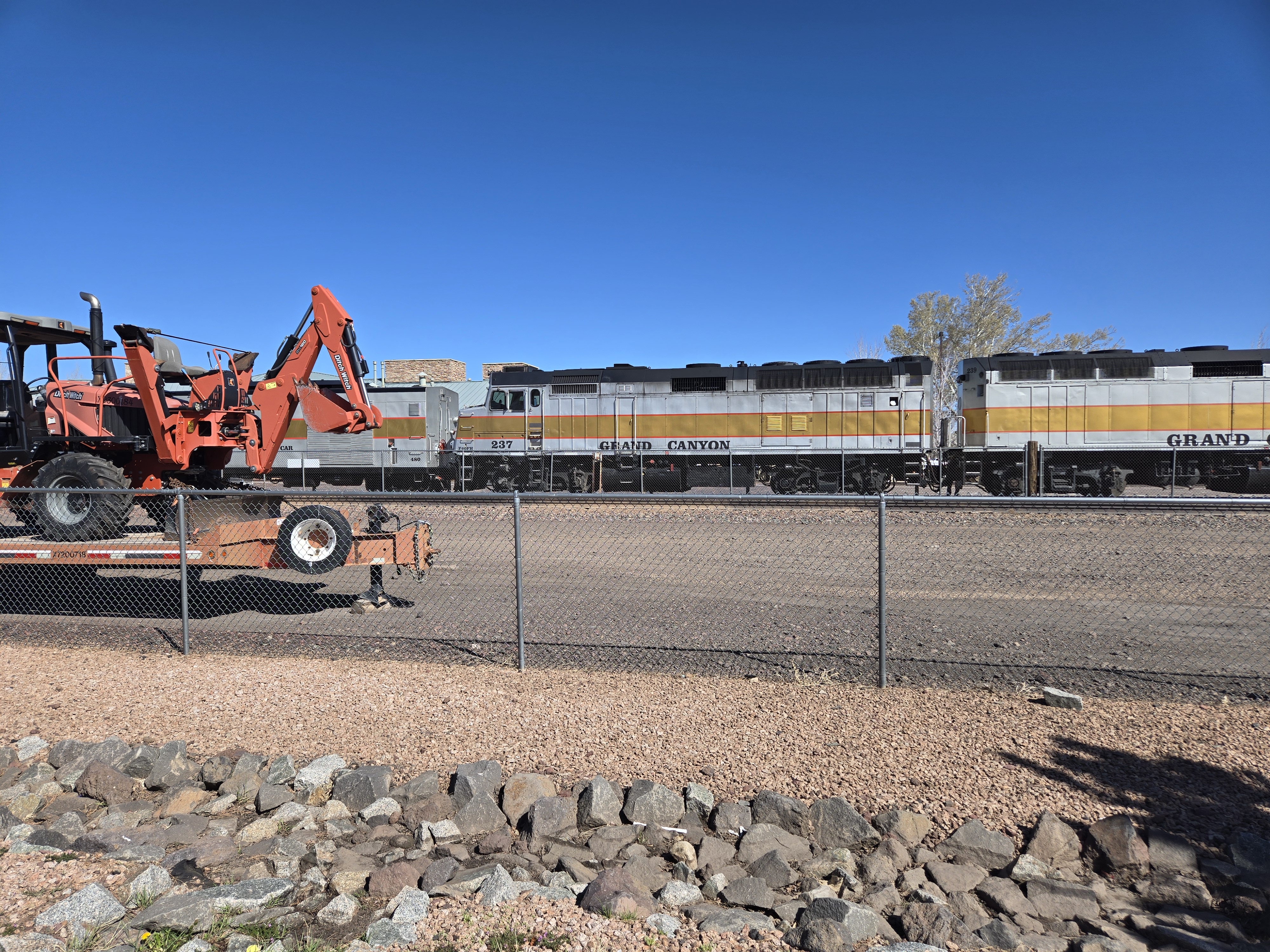
Williams also happens to be the location of the start of the Grand Canyon Railway, so I figured I’d drive over and snap a few pictures. Well my timing was great because I was able to catch the departure of the northbound train. My day was getting even better! With that I then continued to the Hoover Dam.
The last time I had been there, the highway itself still crossed the top of the dam. I knew they had built a new bridge to change this, partly to alleviate the traffic jams, but also because in a post 9/11 world, the idea of a truck bomb being on top of the dam probably made more than a few people nervous. Though, truth to be told, given the mass of the dam, and sadly the lower water levels these days, I don’t think anything short of a nuke would do enough damage to endanger the dam or anything downstream.
While crossing over the new bridge I noticed a walkway along the side of it. I added this to my list of things to check out. I got off at the exit which interestingly enough is about 2-3 miles beyond the dam so you have to double-back.
I had forgotten the dam is a Department of Reclamation site, not a National Park so my new Park Pass wouldn’t help me here. I also didn’t realize if I had bypassed the large, obvious parking garage I could have driven across the dam, driven up the other side a bit and parked for free, saving myself $10. Ironically enough, at the end of the day I decided to do this drive anyway to get some other pictures. So, my advice, if you go, drive all the way across the dam, avoid the one paid parking lot on the other side and continue up. You’ll probably find free parking. Yes, it’s a bit more of a walk, but if you’re like me, you would end up walking over there anyway to check out the views.
Once parked I took the escalator down to the entrance and decided to do the full dam tour (or whatever it’s called). It gets you into a few more places. It’s $30. I’ll admit, I’m still not sure I got my money’s worth. But off I went. First a video of the making and history of the dam and then waiting for my tour time.
Finally I was off for the tour. First we saw one of the bypass tunnels used to divert the Colorado River during the construction. It’s a rough hewn rock tunnel about 50’ in diameter. It’s pretty cool. You stand in a room built inside it atop one of the main penstocks that’s 30’ in diameter. There’s a dull rumble and hum below your feet as thousands of gallons of water per second flow by.
From there you get to see the generator room on the Nevada side. One thing most people don’t realize (and I’ll admit I had forgotten) was that the primary reason for building the dam was flood control and to provide a steady water supply for communities like Las Vegas. The power was secondary and in some ways runs contrary to its primary goal (because the more power they generate, the less water they preserve behind the dam). This is particularly important today with the ongoing climate change because there’s a definite need for the power for communities like Las Vegas, but there’s also been far less snowfall the past winters so there’s far less snowpack, which means less snowmelt, which means the reservoir is far from capacity. In fact as of now, it’s only about 33% full. It’s 165.6’ below what’s considered “full”. Full is considered 1229’ above seal level. It’s at 1063.4’ as I write this. What’s known a deadpool level is 8% capacity and a water level of only 895’ At this level no power can be generated and now water can make it past the dam (since the only outlets for water are through the intake towers and down the penstocks.) I’m sadly betting that some of my readers will see Lake Mead reach deadpool in their lifetimes. (I think there’s a chance I might see it!)
If you only paid for part of the tour, there’s apparently not much more to see. But as I paid the whole dam price, we were taken to see other things, including what’s actually an air vent, but acts like a window on the side of the dam you can look out of. You also get to see an internal staircase that runs from the bottom of the dam all the way to the top. Yes, this is within the dam. The dam itself is not solid but as a number of access tunnels. One purpose of these tunnels is to permit inspection of the large concrete blocks that make up the dam and to monitor any stress cracks forming, other deformation, and more. Also, internal to the dam are seismometers. Originally these were apparently very low tech: literally bowls of mercury on tripods. Being dense, mercury won’t spill out unless something pretty strong shakes the tripod. These have since been replaced by electronic devices, which are in a box on the floor along the path of the tour. So you’re asked VERY firmly to NOT kick the boxes. I think the threat that it stops all the elevators and we’d have to walk that staircase up and out also helps people from doing that.
Another interesting detail about the dam is that it is in fact not attached to the side walls of the canyon in anyway. The mass of water pushes against the arch shape of the dam, holding it in place. This also means that when an earthquake does occur (and it’s near a fault line so they do occur) basically the dam can find its new equilibrium with the canyon walls.
After the tour, I wandered the dam area and took a lot of pictures. On the drive out I pulled over at the parking lot for the pedestrian bridge I mentioned earlier.
This is actually a very well done display and I recommend it. It costs nothing. Well, it might cost you your nerves. Once you’re up on the bridge, there’s a VERY strong wind. I held on to my phone extra hard here because I was truly worried the wind might rip it out of my hands. You’re also 800’ above the Colorado at this point. But the view of the dam is incredible and I recommend it.
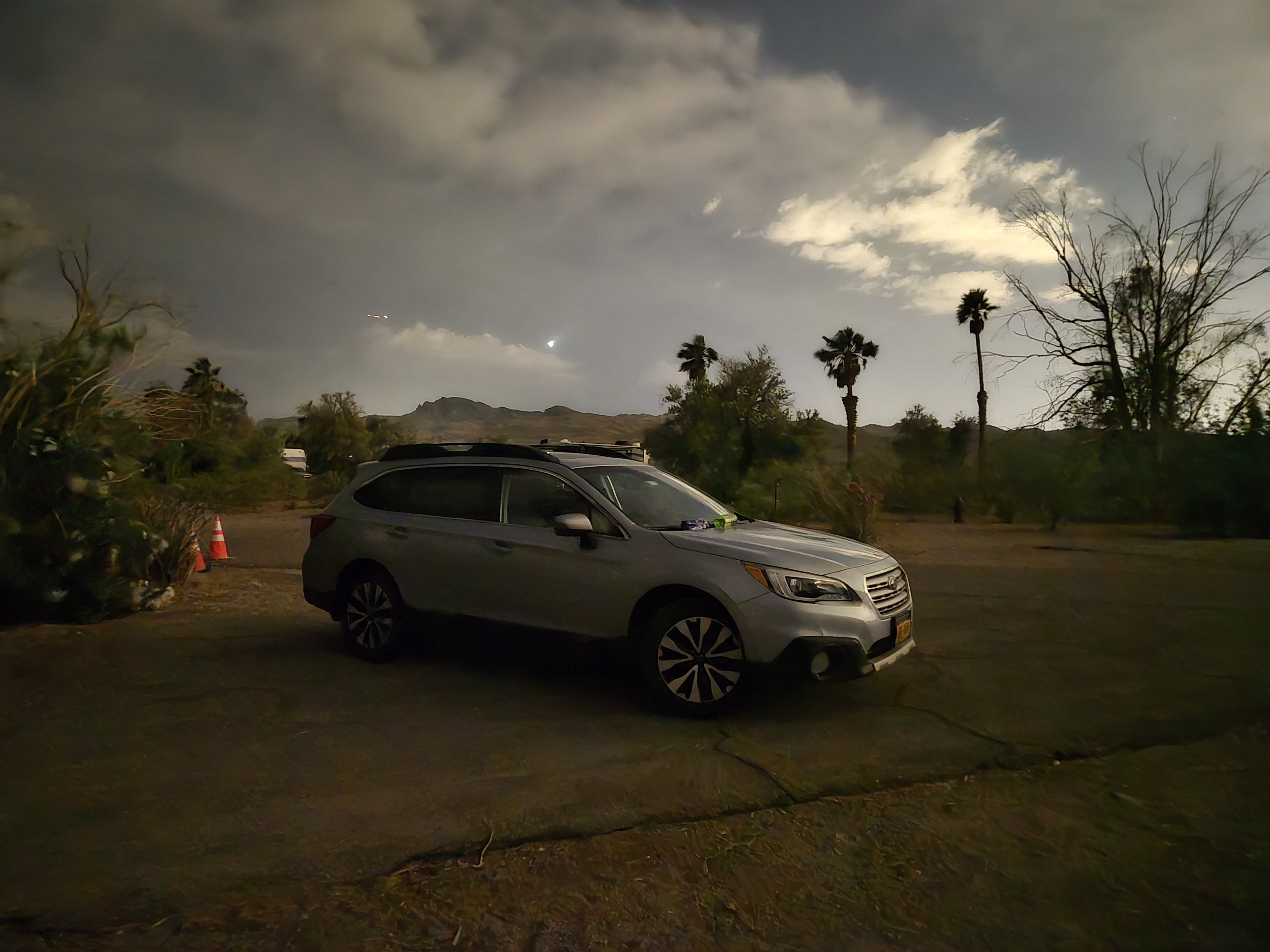
After that I headed into Boulder City for dinner and the Las Vegas Bay campground for the night. The campground itself was nothing much. I’m pretty sure when Lake Mead was higher there was an actual by nearby. But tonight, the shore was miles away. You can see on the drive in how much the lake shore has retreated and how some of the boat launch facilities, etc have had to move down the shore more and more to keep up.
I did manage to see a massive thunderstorm far across the lake, but it never bothered me. And with that, I was off to sleep.
My goal was to get an early start and beat the heat. After my last hike (29 years ago on my honeymoon with Randi) we failed to do that. In spectacular fashion. But let’s just say if running out of water on the hottest (or nearly so) day of the year in the Canyon can test a marriage and here we are 29 years later, I suppose we did ok.
The Backcountry Office had given me two options. One was to catch a 6:00 AM shuttle to the Kaibab trailhead or to try to snag one of the 12 spots at a small lot just off the road to the trailhead. I figured I’d wake up in the morning and see what my time looked like. Each had its benefits, but waiting for the shuttle meant a possibly later start.
I went to bed soon after dark and so I woke up around 4:00 AM (without an alarm!). I quickly packed and figured I’d risk the parking lot. Sure enough there were plenty of spots available. So after a scramble to grab a last few items from the car (I still forgot some hand sanitizer) I was off. I had to hike to the trailhead (Google says about .7 miles) before I could officially start my hike at 6:15 AM. This gave me about a 20 minute head start over the shuttle bus.
Often when I hike I set two goals: an optimistic one and a pessimistic one. This is even more true when it’s a trail I’m not familiar with or when, like now, I’m not in as good a shape as I’d like to be (and not nearly as young as I used to be!) So, I had an optimistic goal of about 2 miles an hour. That may sound easy, but on a steep trail, much in the Sun, and with a heavy backpack, and given the above age/in-shape factors, I figured I could hope for that. But I’d expect something like 1-1.5mph. My first major goal was the Tonto Trail where it crosses the South Kaibab Trail. There were a few points along the way I’d use to measure my progress.
Well the good news is I did make good time. Based on landmarks, even with stopping to take photos, I was averaging at least 2 mph. I was content. This was my 4th time down the trail, but to be honest, it’s been so long I didn’t remember much, just the general fact that it’s VERY exposed to the Sun and there’s no water. There were some spots that seemed familiar though. Mostly this trail, especially the further you go, is really only recommended for in-shape, experienced hikers who are planning on spending the night. I had two of those three parameters down. So I felt comfortable. And it appears most of the folks I passed on the way down (and I in fact did pass some people who were going down more slowly than me) fit that group. What I didn’t expect to pass was Christopher Robin.
Here is Edward Bear, coming downstairs now, bump, bump, bump, on the back of his head, behind Christopher Robin. It is, as far as he knows, the only way of coming downstairs, but sometimes he feels that there really is another way, if only he could stop bumping for a moment and think of it. And then he feels that perhaps there isn’t. Anyhow, here he is at the bottom, and ready to be introduced to you. Winnie-the-Pooh.
I first spotted this hiker from a switchback perhaps 30′ above him and a few hundred yards away. At first I thought he was standing next to some sort of small structure or something that perhaps the Park Service had put there to monitor the weather or something. It looked flat, smooth, and very obviously man-made.
But as I got closer I was even more confused. It was in fact not something the Park Service had put there. In fact I’m not 100% sure they would have approved of it being there at all.
It was… a kayak. Yes, you read that right a kayak.
I asked him what his plan was and it was in fact to hike to the Colorado and put in and canoe down some number of days (I forgot how many he said). I wished him luck and continued on my way.
It was a few minutes later when I took a water break that I could here the thump thump of the kayak as it bounced down the trail behind him. That’s when I named him Christopher Robin and his kayak Winnie-the-Pooh. Strangely, about 30 minutes later I met 3 folks hiking up from the river (or at least the Tonto Plateau) who asked if I had seen a guy with a kayak. I’m not sure if they were friends or had simply heard about him. In any event, I never saw him again and hope he made it.
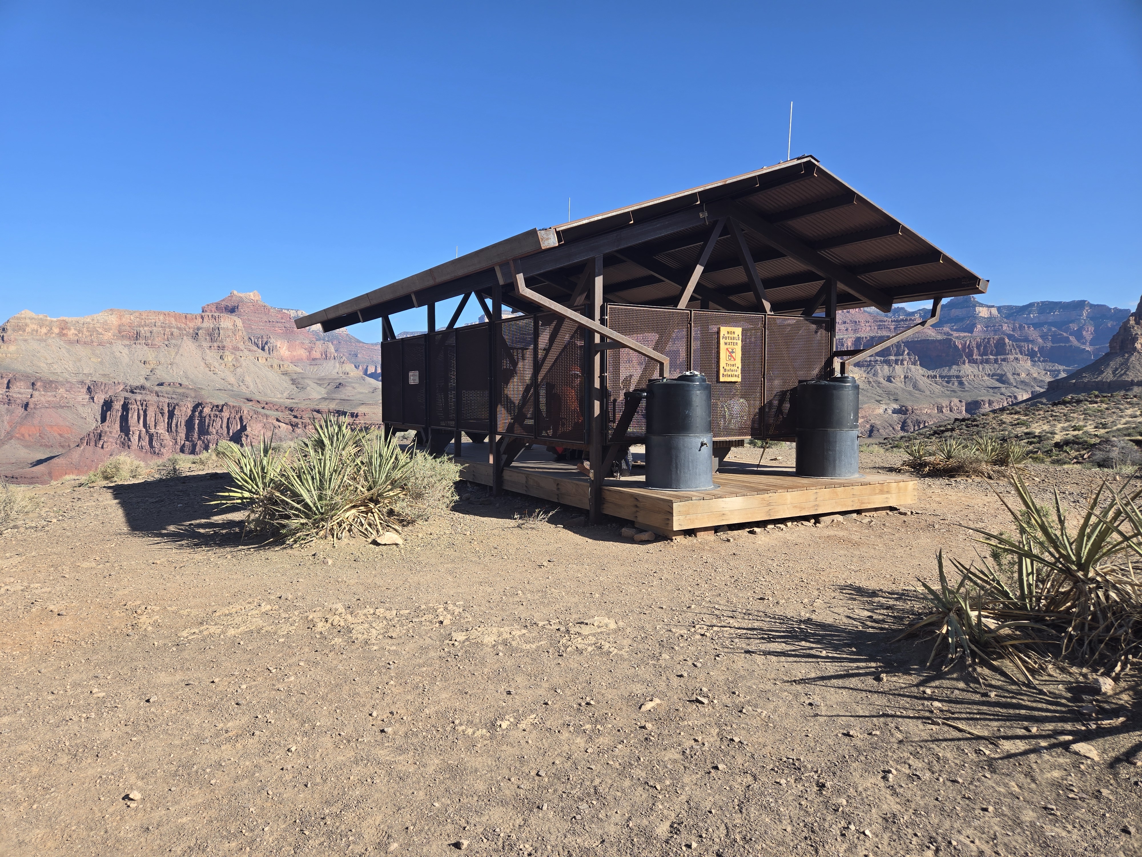
Once at the trail junction I noticed what I’m pretty sure is a new structure since I was there 29 years ago, a Sun shelter. This is in addition to the composting toilets that have been there for as long as I’m aware. Randi and I could have used this last time.
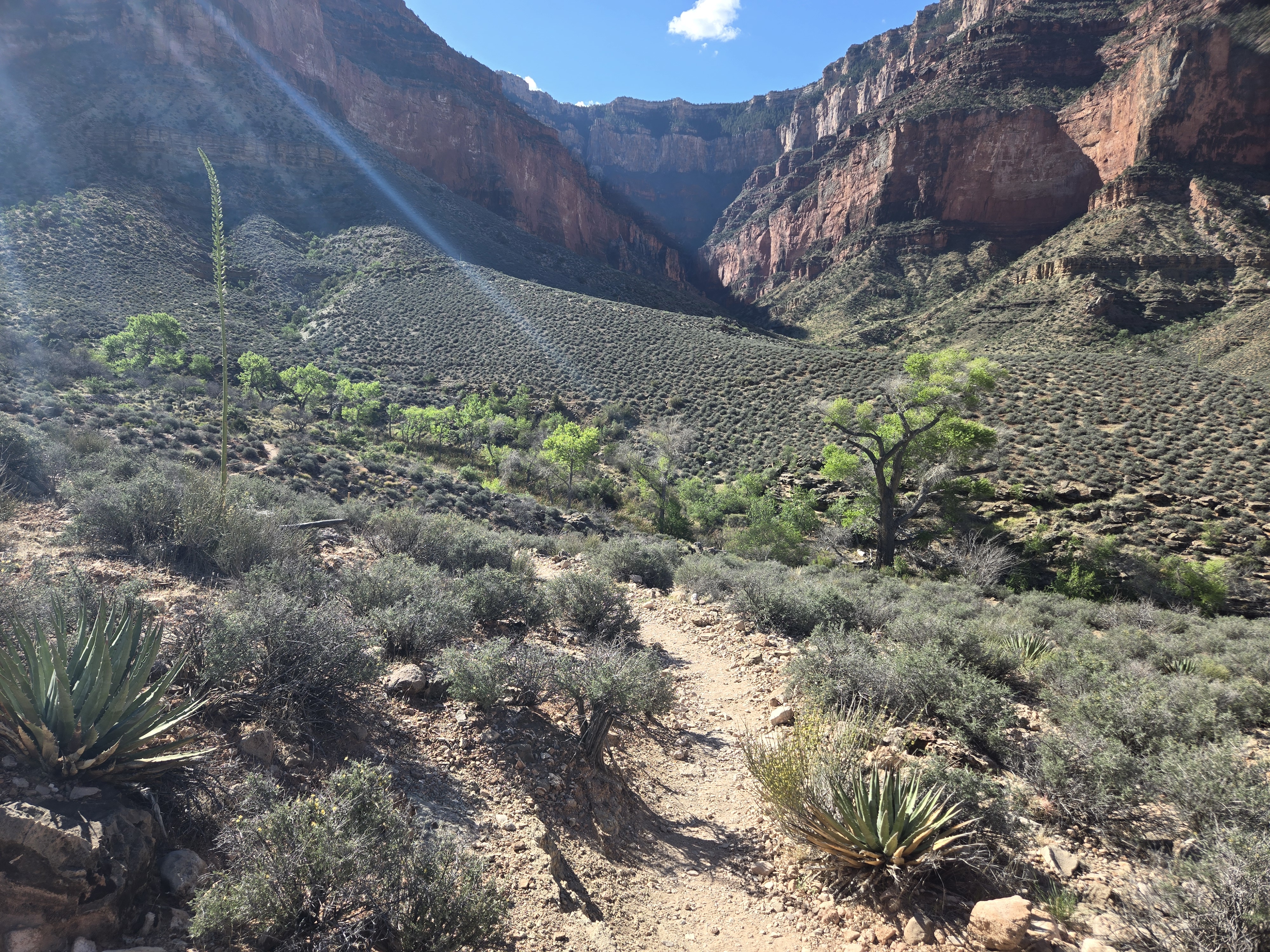
I got here at 8:15, so I was definitely making good time. After a 10 minute potty break and water/food break I was on my way to terra incognita: the Tonto Trail headed west to Havasu Gardens. This was a trail I had never done before. I wasn’t too concerned. It’s fairly flat and there’s non-potable, but treatable, water along the way if I really needed it. The only concern was the Sun. But off I set. I won’t bore you with details. It was uneventful, I saw very few hikers. And I made good time. I will note it’s very obvious in the Canyon where water is. The Cottonwoods grow.
Again, I was making excellent time and was pleased with my progress. I even managed to find a few stretches that still had some shade. My plan of starting very early was paying off.
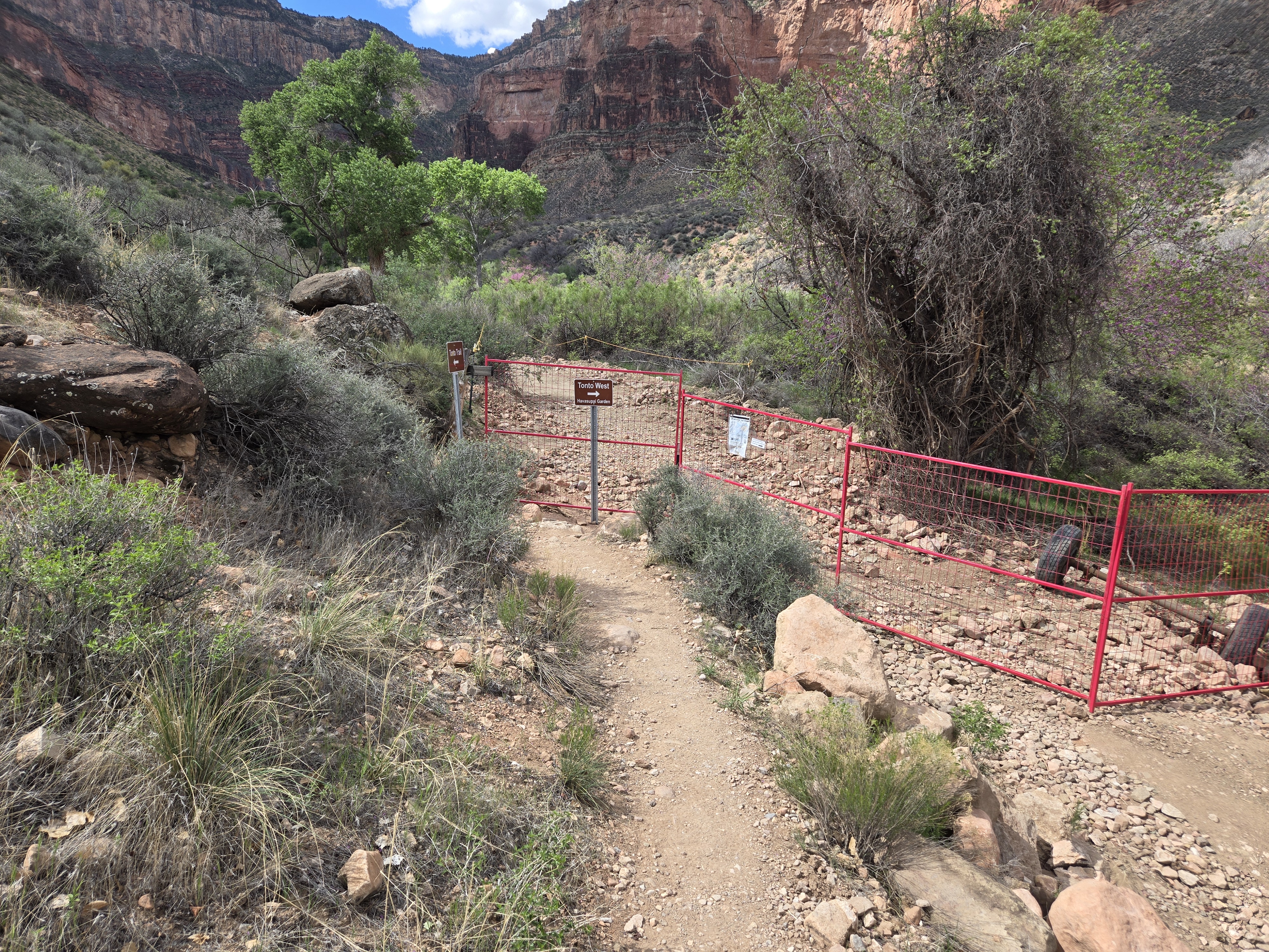
That said as I approached Havasu Gardens I was in for a bit of a surprise and disappointment. Due to the trail construction and pipeline work, rather than hiking into Havasu along the contour I was on, I had to turn away from the Gardens, descend, cross back up a steep section. It was both physiologically and mentally draining. So close and this small hurdle.
But I made it, and well in the time I wanted. I was at Havasu Gardens by 10:53. I was content.
The rest of the day was spent relaxing, reading, and some photo taking. One of the other hikers spied something that caused the Park volunteer to put out a warning sign. I’ll pause to say, if you don’t like snakes, don’t look at the final picture!
Overall, a great day of hiking and I loved being back in the Canyon again and getting the chance to try a new trail! My only concerns… the hike out. Again I wanted an early start. Which I managed to get. More in the next post.