Again, posted a day late.
I’ve mentioned not being on a strict schedule. Which is good. Originally I was going to leave Monday the 7th, after work. But a car repair wasn’t done by then. So then it was going to be Tuesday morning. Of course it ended up being Wednesday around Noon. My original goal had me arriving at the Canyon on Thursday morning. By postponing my departure by 2 days, I figured I could still make it to the Canyon by Saturday morning.
Well here it is, Sunday night and I just arrived after dark (8:37 local time, 11:37 Eastern time). But I’m ok with that. I even managed to score a campsite in the Park itself (which meant not having to find a place along the way). But why the delay?
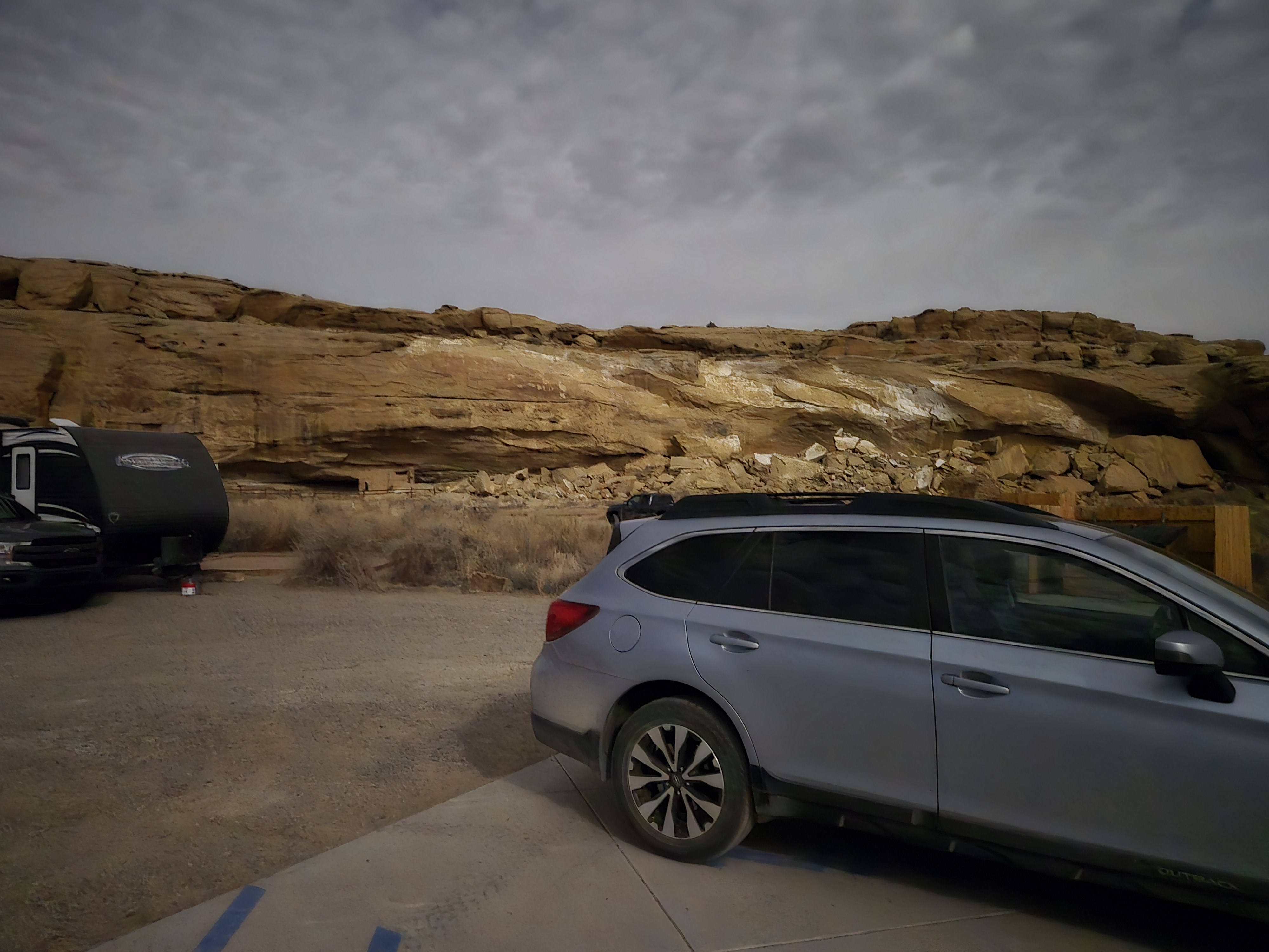
Well as the previous post notes, I had some car issues that slowed me down. And of course I ended up visiting and staying at Chaco Canyon. But that’s only like a 6 hour drive from the Grand Canyon and I left there around 10:00 AM MDT. So why so late?

Well for one thing I decided to do a bit of food shopping since the next few days stopping by a restaurant was less likely and I was running out and getting sick and tired of what I had packed when I left New York. While paying for the food, I started to panic since I couldn’t find one of my credit cards. I had just used it 8 miles up the road for gas, so I figured I could call to see if they found it and go back. After a frantic search of the car and my pockets multiple times, I did find it in one of my pockets. So I could breath a bit easier after that.
Back on the highway, I still was thinking I’d make the Canyon, specifically Mather Campground, well before dark. I wasn’t scared.
But soon I was petrified. Ok, no, not really. But I saw signs for the Petrified Forest National Park. My paternal grandparents had had a slice of petrified wood that always fascinated me and as such I had always wanted to check it out. A quick check of Google confused me a bit, since it looked like there was a few spots it was calling attention to. But no worry, the entrance was quite literally off the Interstate. I figured I’d pop in, check it out and 20 minutes later be on the road.
Little did I know that actually that’s the North Entrance and the road takes you about 26 miles south to the South Entrance. Along the way there are pull-offs to see the Painted Desert, Blue Mesa and much more. The ranger warned several of us that it could take a couple of hours. He was right. But it was well worth it.

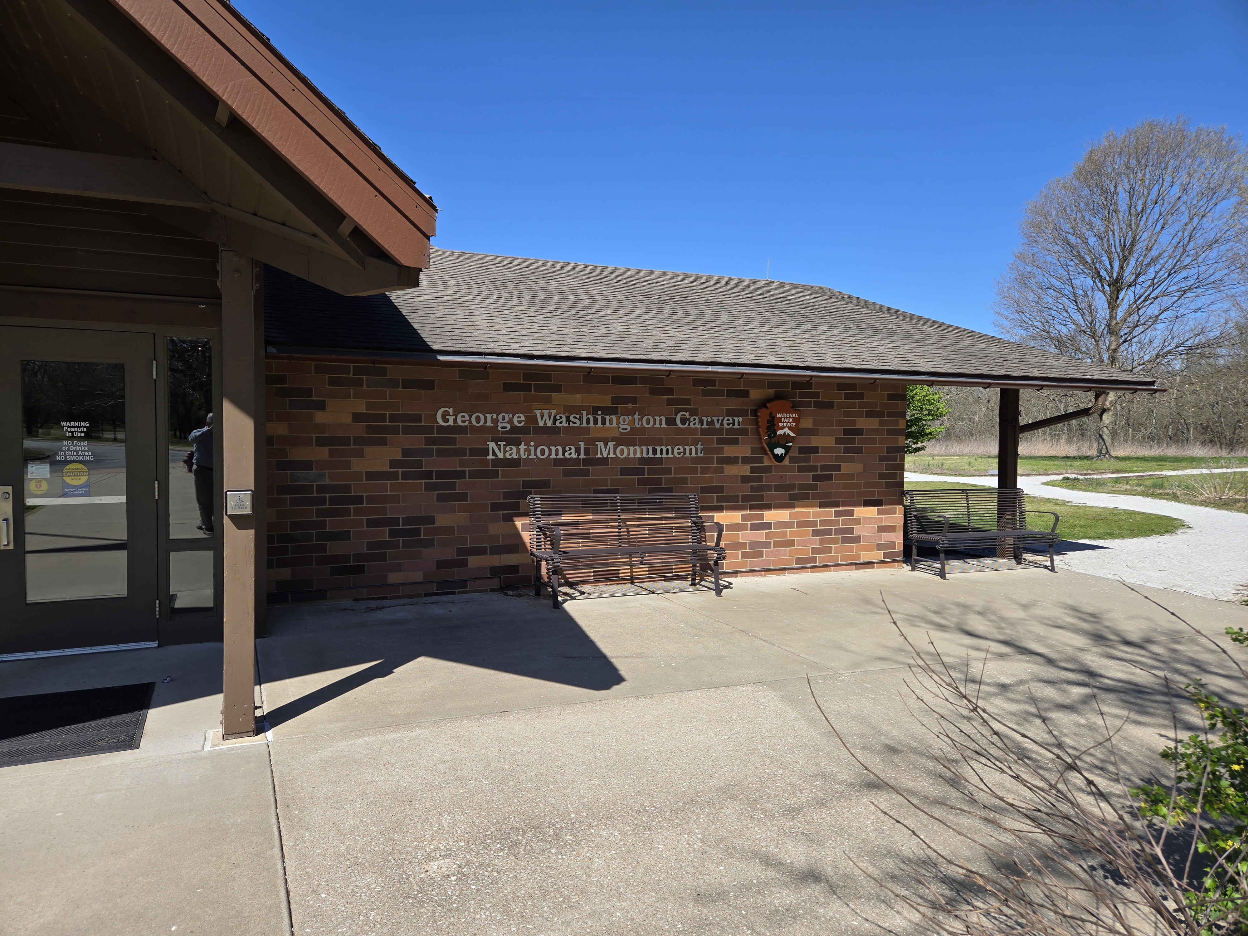
A side note, at Chaco I had decided to pay $80 for an annual pass for the National Parks (in 5 years I can get a lifetime one for the same price, I guess a perk of getting older). Well Chaco is $25, Petrified is $25 and the Grand is $35. So it’s already paid for itself and I have other parks I want to visit on this trip. I also picked up a Park Passport at Petrified so I can collect stamps. Why not.
Anyway, I still had hope to make it to the Grand Canyon before sundown but another sign caught my eye: 65 miles to Winslow. Yes, THAT Winslow Arizona. Since I suppose I’m trying to take it easy on this trip, I just knew I had to stop. And I did. And of course got pictures. And I was far from the only one doing so. At least two other groups were doing the same.

At this point though, any chance of making the campground by sundown was gone. But, it was well worth it.
I’ll add one more note before ending. Several times on this trip, including in Winslow, I’ve managed to be on bits and pieces of the Mother Road, Route 66. And it’s been both cool and sad seeing some of the old hotels (most now dilapidated), restaurants (closed), and gas stations (abandoned).